| Area |
Jacoby Creek |
| Topic |
Map: J. Timber Harvest Plans, Jacoby Creek Sub-basin |
|
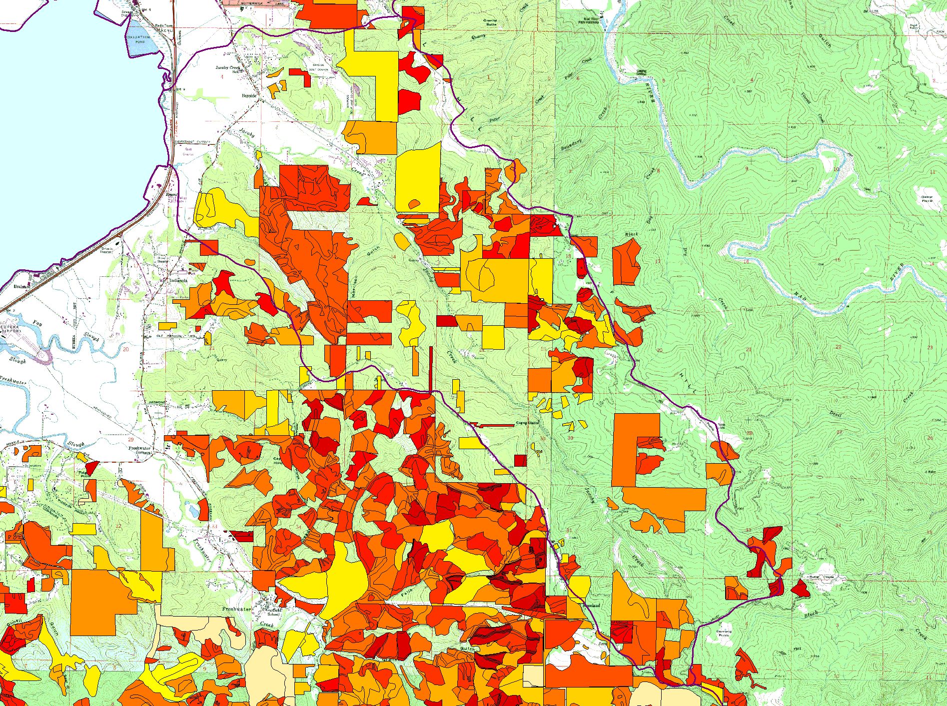
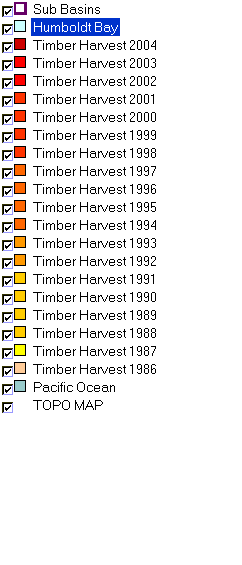
This is a map of timber harvest plans within the Jacoby Creek sub-basin. Specific themes include CDF timber harvest plans from 1986 through 2004. Click the check
box next to a layer to toggle it on/off. Other themes include: change scene detection, roads, streams, towns, planning watersheds, elevation, and a TOPO map.
Additional information regarding harvest plans can be viewed either by clicking on the "show attribute table for active layer" button at the top right, or by clicking the
"Information tool" button at the top left and then selecting the polygon of interest. Make sure that the polygon theme is active or the Information tool will not work. Scale = 1:42,203 .
|
|
|
 |
 |
To view metadata about a map layer, click on a link in the table below.
| Name of Layer in Map Legend | Metadata File Name |
|---|
| Sub Basins | subbasins.shp.txt |
| Humboldt Bay | Unavailable |
| Timber Harvest 2004 | Unavailable |
| Timber Harvest 2003 | Unavailable |
| Timber Harvest 2002 | Unavailable |
| Timber Harvest 2001 | Unavailable |
| Timber Harvest 2000 | Unavailable |
| Timber Harvest 1999 | Unavailable |
| Timber Harvest 1998 | Unavailable |
| Timber Harvest 1997 | Unavailable |
| Timber Harvest 1996 | Unavailable |
| Timber Harvest 1995 | Unavailable |
| Timber Harvest 1994 | Unavailable |
| Timber Harvest 1993 | Unavailable |
| Timber Harvest 1992 | Unavailable |
| Timber Harvest 1991 | Unavailable |
| Timber Harvest 1990 | Unavailable |
| Timber Harvest 1989 | Unavailable |
| Timber Harvest 1988 | Unavailable |
| Timber Harvest 1987 | Unavailable |
| Timber Harvest 1986 | Unavailable |
| Pacific Ocean | Unavailable |
| TOPO MAP | Unavailable |
If you obtain KRIS on a CD and install it on your hard drive as a desktop program, you will have access to increased map capabilities such as zooming in/out, turning layers on/off, adding layers and changing legends.
