| Area |
Salmon Creek |
| Topic |
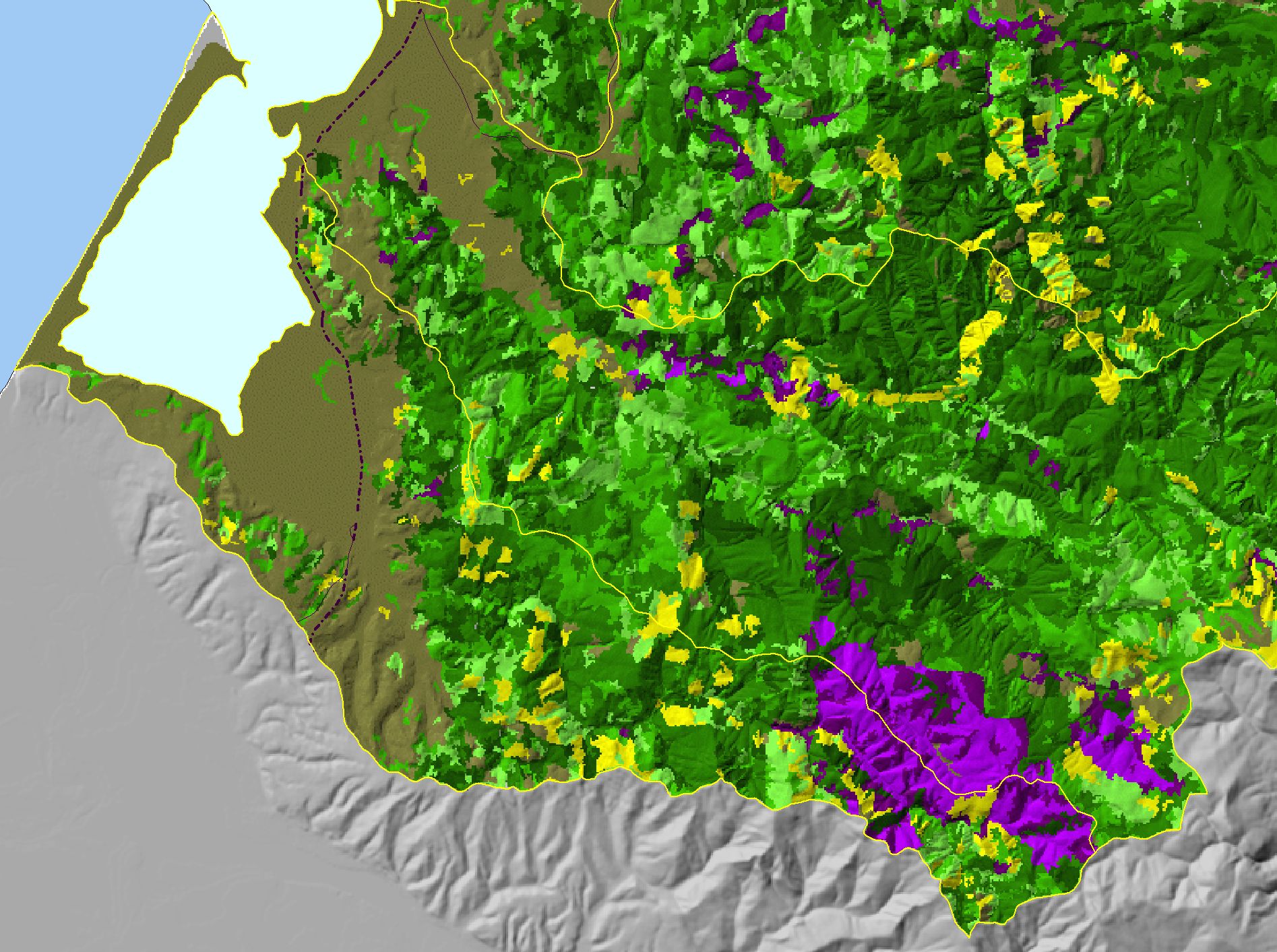
Map: E. USFS Vegetation Size, Salmon Creek Sub-basin |
|
This is a map of 1999 USFS Landsat-based vegetation size data for the Salmon Creek sub-basin. The vegetation classification is accurate at a one-hectare scale
(approximately 11 pixels) and is suitable for stand classification. Most of the area in this sub-basin is forest or actively harvested forest, from saplings to large trees.
Headwaters Forest can be seen to the southeast, with purple representing very large and giant trees. Some non-forest land (agricultural) lies to the west. Data provided
by the U.S. Forest Service Spatial Analysis Lab in Sacramento, CA.
|
|
|
 |
 |
To view metadata about a map layer, click on a link in the table below.
| Name of Layer in Map Legend | Metadata File Name |
|---|
| Sub Basins | subbasins.shp.txt |
| Humboldt Bay | Unavailable |
| Roads (1:100k) - Abbreviated | Unavailable |
| Relief Vegetation by Size (USFS 1999) [TIFF} | shadesize99.tif.txt |
| Gray Hillshade (30 meter Resolution) [TIFF] | grayshade30m.tif.txt |
| Pacific Ocean | Unavailable |
If you obtain KRIS on a CD and install it on your hard drive as a desktop program, you will have access to increased map capabilities such as zooming in/out, turning layers on/off, adding layers and changing legends.
