
| Area | Middle Klamath |
| Topic | Flow: Minimum Flows of 10-20 sq.mi. Mid-Klamath Tributaries 1996-2002 |
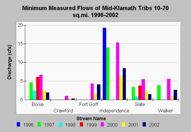
| Caption: This chart shows minimum measured streamflow measurements of Middle Klamath tributaries with catchment areas between 10 and 20 square miles. Streamflow measurements were taken on varying dates from June through November between 1996 and 2002. See the Source Table for details on measurement dates and locations. Data are from the Klamath and Six Rivers National Forests. See Info Links for more information. | |
 |
To learn more about this topic click Info Links .
To view additional information (data source, aquisition date etc.) about this page, click Metadata .
To view the table with the chart's data, click Chart Table web page.
To download the table with the chart's data, click flow_mid_klam_tribs_karuk_10to20sqmi.db (size 4,096 bytes) .
To view the table with the chart's source data, click Source Table web page.
To download the table with the chart's source data, click flow_mid_klam_tribs_karuk.dbf (size 28,200 bytes)
| www.krisweb.com |