
| Area | Middle Klamath |
| Topic | Sediment: Landslides and ERFO Sites (1997) |
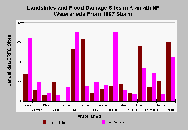
| Caption: The chart above shows the number of landslides observed on aerial photographs in Klamath and Scott River tributaries and the number of flood damage (ERFO) sites by sub-basin. Neither landslide numbers nor ERFO sites as shown above can be directly related to sediment yield to the stream. However, those tributaries with the high numbers of ERFO sites and landslides did sustain considerable cumulative effects flood damage at least to lower stream reaches. Higher numbers of sites may reflect larger watershed area. Walker Creek was the most severely flood-damaged stream (see Picture). Data from De La Fuente (1998), but was derived by counting locations on paper maps, not from an electronic data source. See Info Links for more information. | |
 |
To learn more about this topic click Info Links .
To view additional information (data source, aquisition date etc.) about this page, click Metadata .
To view the table with the chart's data, click Chart Table web page.
To download the table with the chart's data, click erfo.dbf (size 578 bytes) .
| www.krisweb.com |