
| Area | Middle Klamath |
| Topic | Map: Mid Klamath Checkerboard Region Water Quality & Quant. (hotlink) |
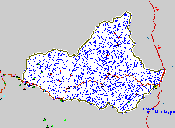
| This is a map of Water Quality and Quantity Monitoring Sites in the Checkerboard region. Temperature monitoring sites shown in red are hotlinked to charts. To view a chart, click on a red triangle. | |||
 |
 |
||
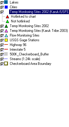
To view metadata about a map layer, click on a link in the table below.
| Name of Layer in Map Legend | Metadata File Name |
|---|---|
| Lakes | lakes.shp.txt |
| Cities | kb_cities.shp.txt |
| Temp Monitoring Sites 2002 (Karuk/USFS) | temps_knf_mwats.shp.txt |
| Temp Monitoring Sites 2002 | temp_pts.shp.txt |
| Temp Monitoring Sites (Karuk Tribe 2003) | mk_temp_sites.shp.txt |
| Flow Monitoring Sites | flow_sites.shp.txt |
| USGS Gage Stations | md_gs_utm.shp.txt |
| Highway 96 | hwy_96.shp.txt |
| Interstate 5 | i5.shp.txt |
| 500K_Checkerboard_Buffer | 500k_checkerboard_buffer.shp.txt |
| Streams (1:24k scale) | kb_fish.shp.txt |
| Checkerboard Area Boundary | checkerboard.shp.txt |
| Elevation (in meters) | mk_elev.tif.txt |
| Grey Hillshade | mk_hlshd.tif.txt |
| www.krisweb.com |