
| Area | Middle Klamath |
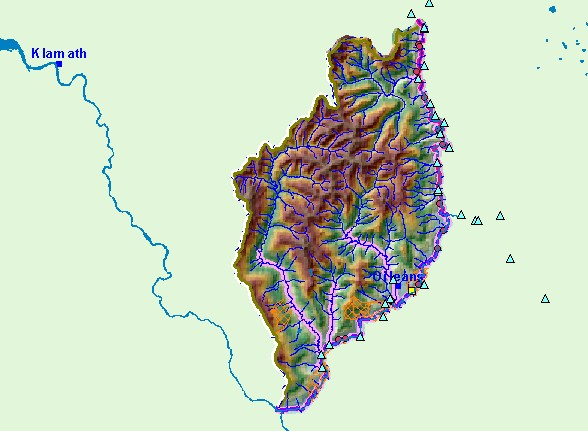
| Topic | Map: Mid Klamath Orleans Region |
| This is a map of the Orleans region. | |||
 |
 |
||
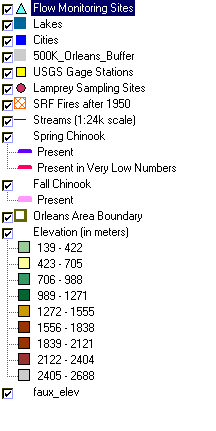
To view metadata about a map layer, click on a link in the table below.
| Name of Layer in Map Legend | Metadata File Name |
|---|---|
| Flow Monitoring Sites | flow_sites.shp.txt |
| Lakes | lakes.shp.txt |
| Cities | kb_cities.shp.txt |
| 500K_Orleans_Buffer | 500k_orleans_buffer.shp.txt |
| USGS Gage Stations | md_gs_utm.shp.txt |
| Lamprey Sampling Sites | lamprey_sites.shp.txt |
| SRF Fires after 1950 | srf_mkfire.shp.txt |
| Streams (1:24k scale) | kb_fish.shp.txt |
| Spring Chinook | kb_fish.shp.txt |
| Fall Chinook | kb_fish.shp.txt |
| Orleans Area Boundary | orleans.shp.txt |
| Elevation (in meters) | mk_elev.tif.txt |
| Grey Hillshade | mk_hlshd.tif.txt |
| faux_elev | faux_elev.shp.txt |
| www.krisweb.com |