
| Area | Middle Klamath |
| Topic | Tour: Aerial Photos Elk Creek Post 1997 Flood |
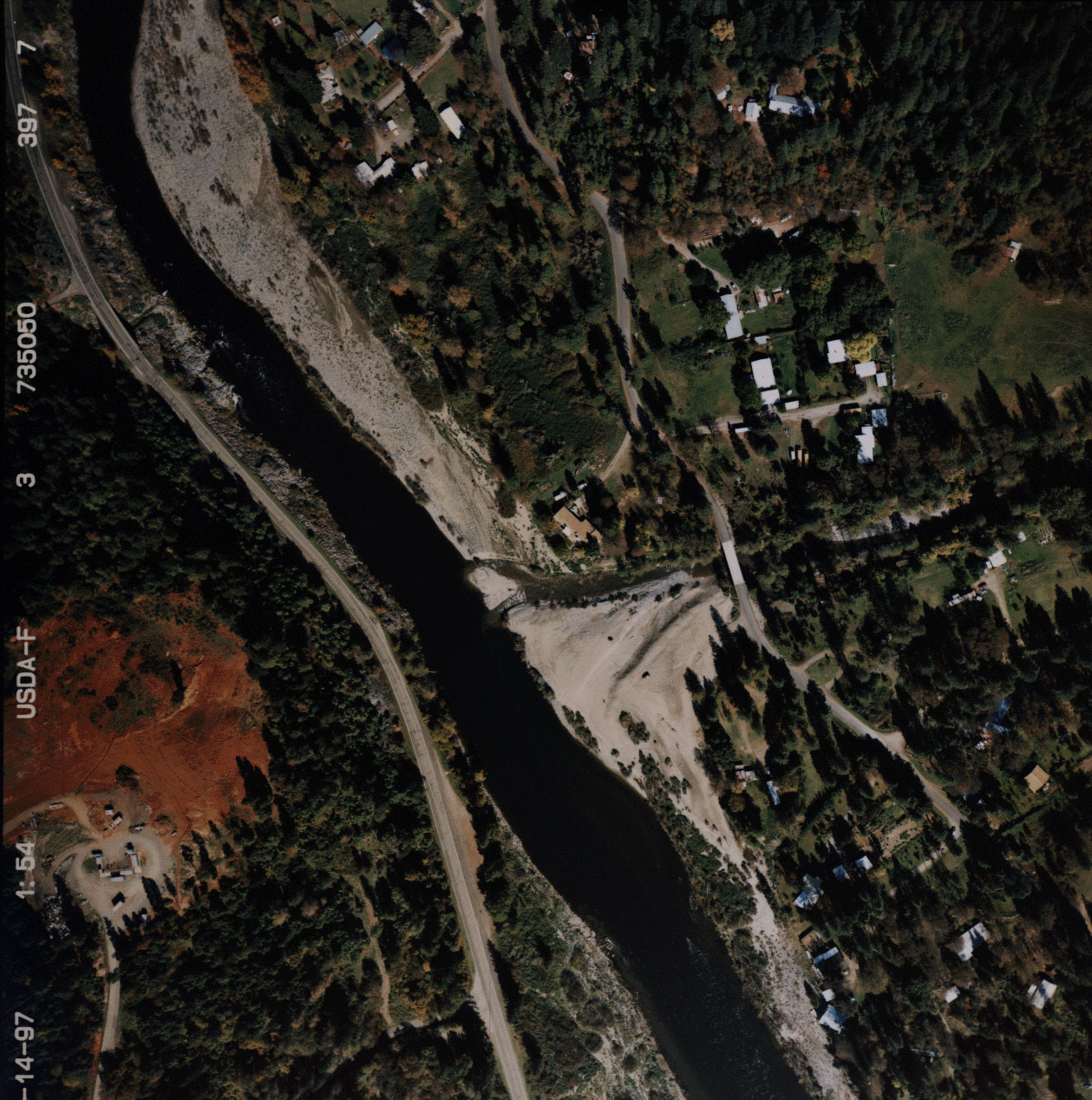
This aerial photograph shows the mouth of Elk Creek below Happy Camp. Elk Creek sustained considerable damage during the January 1997 storm event. Note the large delta at the mouth that denotes significant sediment transport and deposition. The upper watershed was extensively burned in 1987 and subsequently salvage logged. Photos taken by the USFS to assist in flood damage assessment and analysis and provided for use in KRIS. October 1997. Use Pan function or click Fit to see whole image. Press F1 for help in use of Picture tools.
This reach of lower Elk Creek, just above development near the mouth, is a transport reach (a narrow, confined channel with moderate to high gradient). Consequently, deposition of sediment is not in evidence after the January 1997 storm at this site. Photos taken by the USFS to assist in flood damage assessment and analysis and provided for use in KRIS. October 1997.
This reach of Elk Creek is lower gradient and sediment deposition is evident after the January 1, 1997 storm. Although extreme channel widening has not taken place as in Walker Creek, the decreased depth of pools and moderate widening in restricted reaches lead to a warming of Elk River after the flood (De La Fuente, 1998). Photos taken by the USFS to assist in flood damage assessment and analysis and provided for use in KRIS. October 1997.
This reach of Elk Creek is lower gradient and sediment deposition is evident after the January 1, 1997 storm. Although extreme channel widening has not taken place as in Walker Creek, the decreased depth of pools and moderate widening in restricted reaches lead to a warming of Elk River after the flood (De La Fuente, 1998). Photos taken by the USFS to assist in flood damage assessment and analysis and provided for use in KRIS. October 1997. Photos taken by the USFS to assist in flood damage assessment and analysis and provided for use in KRIS. October 1997.
This reach of Elk Creek shows major aggradation as a result of the January 1997 storm event. Wider reaches with low gradient such as the one depicted above are known as response reaches, because they may store sediment. These flat reaches are also the most diverse and complex when a watershed is in equilibrium and often have very high carrying capacity for salmonids. It is in these reaches that large wood and spawning gravels would normally deposit in a healthy watershed. Response reaches also may take decades to recover from sediment depositions. Photos taken by the USFS to assist in flood damage assessment and analysis and provided for use in KRIS. October 1997.
This photo shows the path of a debris torrent as it travels from the narrow confined reaches of a transport reach (at left) to an area of low gradient (a response reach). Channel widening was so significant at this site that the channel of the stream has braided. The bend in the stream may also have constricted the flow of the debris torrent and caused the sediment to deposit. Photos taken by the USFS to assist in flood damage assessment and analysis and provided for use in KRIS. October 1997.
 Click on image to enlarge (443K).
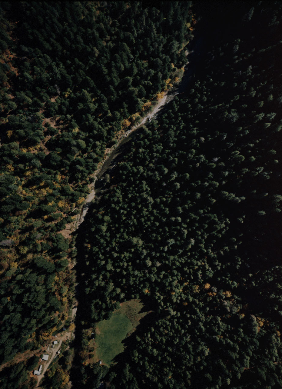 Click on image to enlarge (284K).
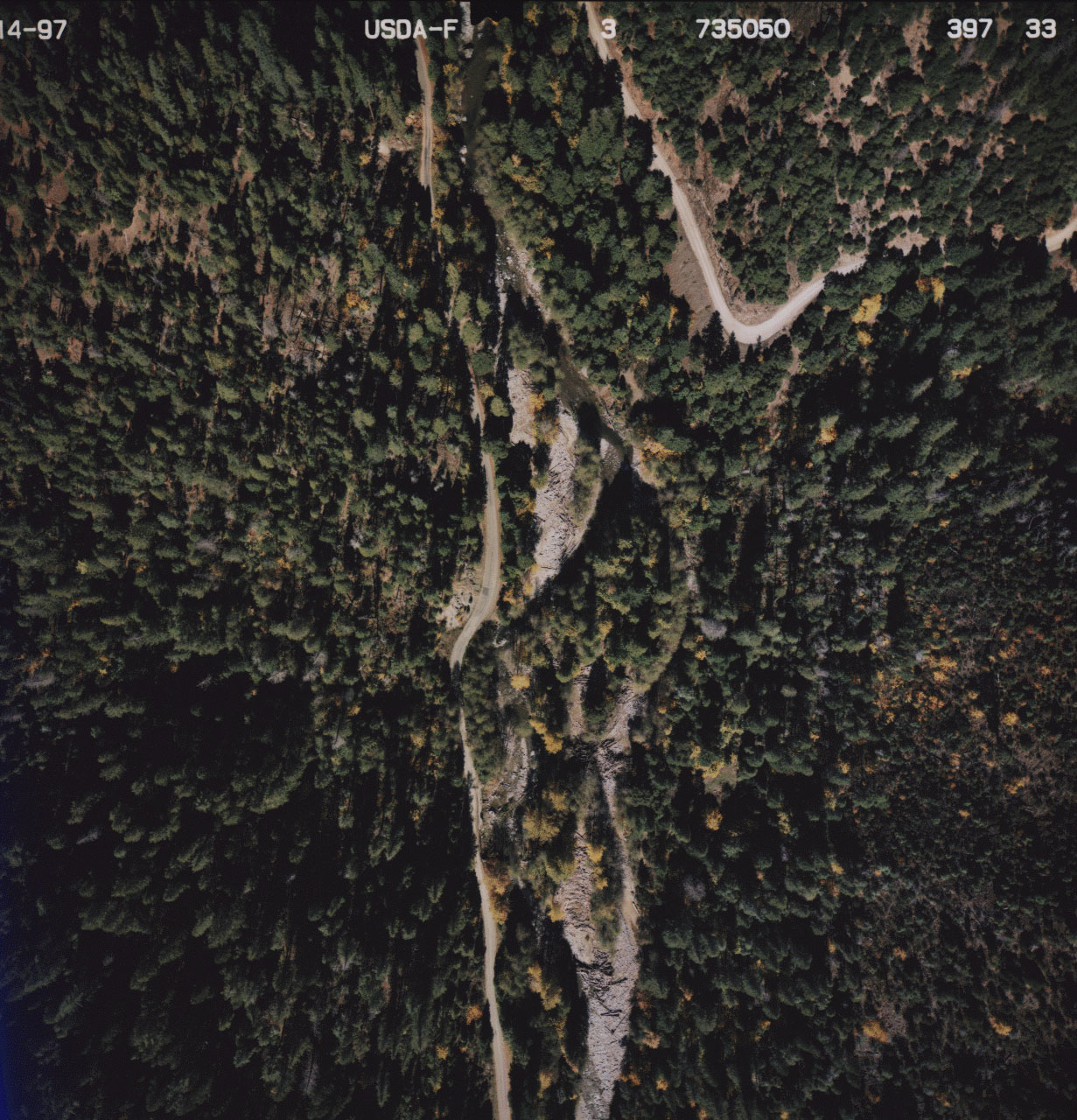 Click on image to enlarge (447K).
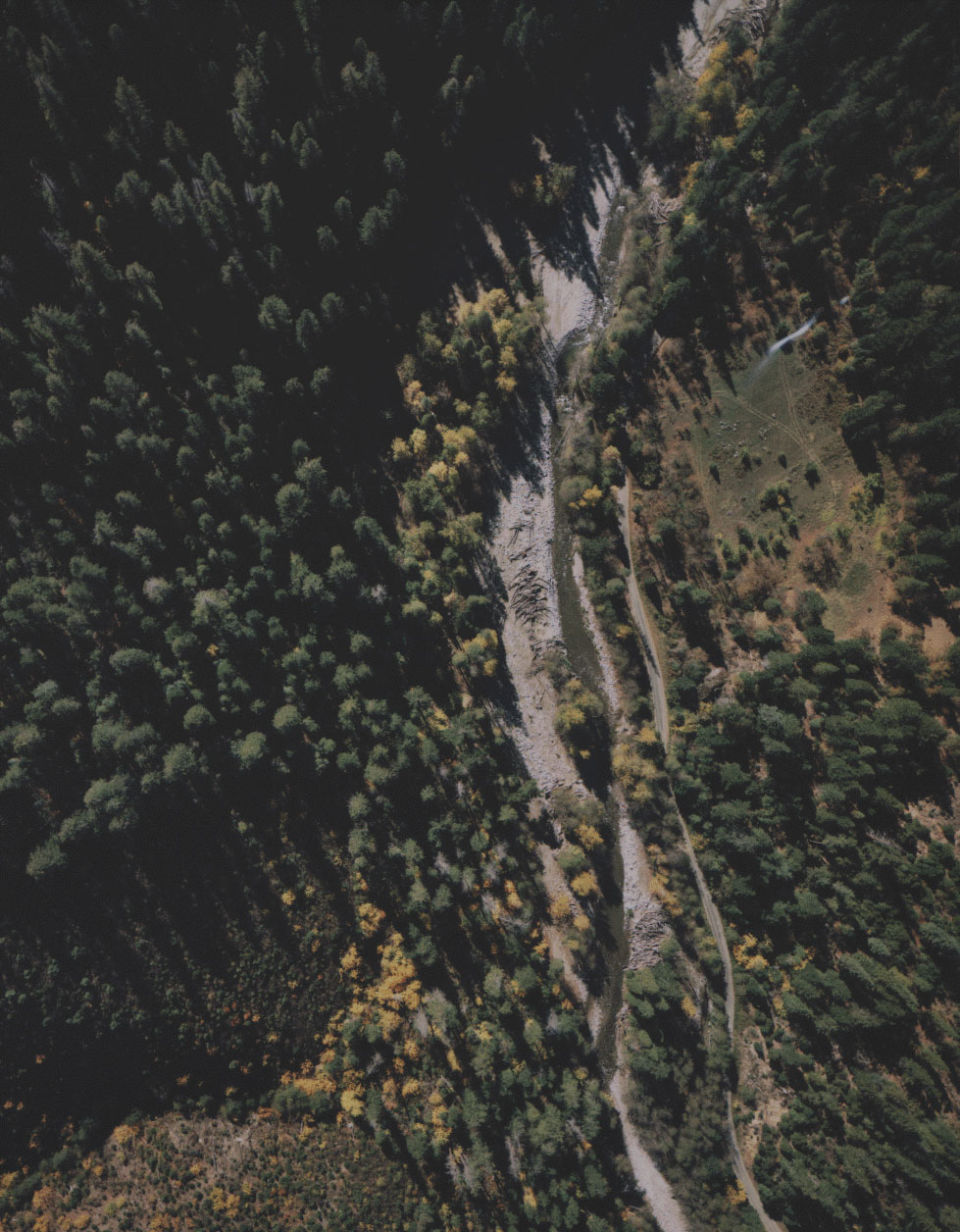 Click on image to enlarge (288K).
 Click on image to enlarge (336K).
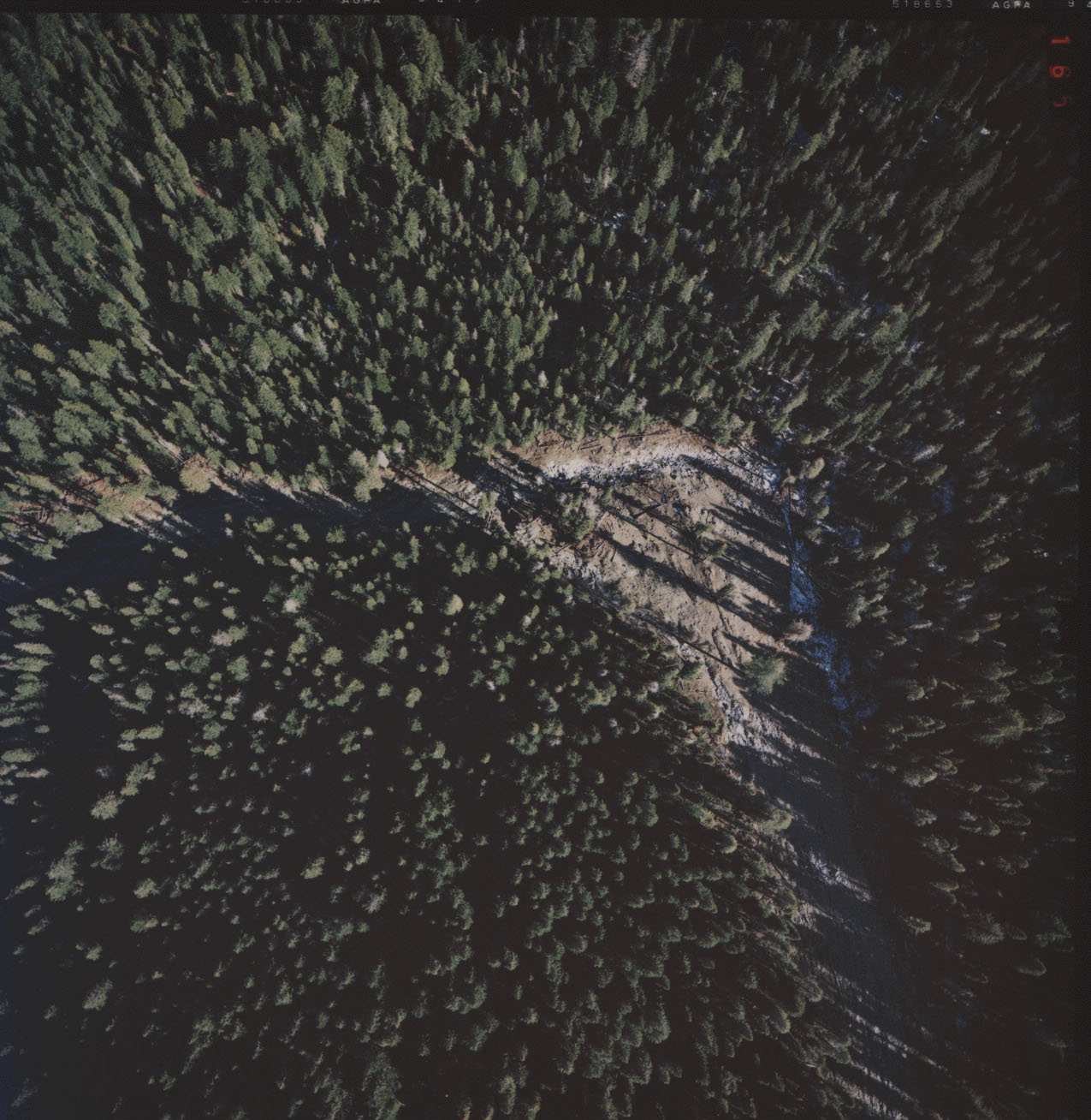 Click on image to enlarge (287K).
To learn more about this topic click Info Links
To view additional information (data source, aquisition date etc.) about this page, click Metadata
| www.krisweb.com |