
| Area | Middle Klamath |
| Topic | Tour: Post 1997 Flood: Mouths of Klamath Tributaries |
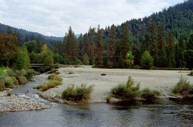
The mouth of Elk Creek as pictured here in March 1997 shows a vast terrace of decomposed granitic sand deposited by the January 1, 1997 storm. Photo by Pat Higgins taken as part of the Mid-Program Evaluation of the Klamath Basin Fisheries Restoration Program (Kier Assoc., 1999). Click on Info Links for more information. Press F1 for help in use of Picture tools.
The mouth of independence Creek in March 1997 shows a substantial deposit of fine and course sediment, including decomposed granitic sand deposited by the January 1, 1997 storm. Note the terrace in the trees to the left of mouth where deposition appears to be on the order of 2-3 meters. Photo by Pat Higgins taken as part of the Mid-Program Evaluation of the Klamath Basin Fisheries Restoration Program (Kier Assoc., 1999). Click on Info Links for more information.
The mouth of Thompson Creek in March 1997. The photo shows that the mouth of this stream became shallower and wider as a result of the January 1997 Storm. It appeared that excavation might have taken place at this site after the flood and prior to the photo. Such activity might have been related to flood control upstream or potential continuing flood effects on the Highway 96 bridge, just upstream on Thompson Creek. Photo by Pat Higgins taken as part of the Mid-Program Evaluation of the Klamath Basin Fisheries Restoration Program (Kier Assoc., 1999). Click on Info Links for more information.
Thompson Creek just above the mouth looking upstream from the Highway 96 bridge. Boulder weirs formerly located here to improve diversity of fish habitat were buried or mobilized by the January 1997 storm. Photo by Pat Higgins taken as part of the Mid-Program Evaluation of the Klamath Basin Fisheries Restoration Program (Kier Assoc., 1999). Click on Info Links for more information.
The mouth of Bluff Creek as pictured here in March 1997 shows that the riparian area was buffeted during the January 1, 1997 storm, but that the riparian area remained intact. This indicates that there was not a major outflow of sediment from Bluff Creek. Photo by Pat Higgins taken as part of the Mid-Program Evaluation of the Klamath Basin Fisheries Restoration Program (Kier Assoc., 1999). Click on Info Links for more information.
Horse Creek joins the Klamath River below the cutbank in the distance at center-right in the photo. In the foreground is the abutment of the bridge across the Klamath River to Horse Creek, which was wiped out by the January 1997 storm. Photo by Pat Higgins taken as part of the Mid-Program Evaluation of the Klamath Basin Fisheries Restoration Program (Kier Assoc., 1999). Click on Info Links for more information.
Picture of the mouth of Beaver Creek taken in March 1997 showing a terrace of decomposed granite next to Highway 96 bridge support. Photo by Pat Higgins taken as part of the Mid-Program Evaluation of the Klamath Basin Fisheries Restoration Program (Kier Assoc., 1999). Click on Info Links for more information.
Looking upstream of Highway 96 just above the convergence of Beaver Creek and the Klamath River in March 1997. See Tour: Restoration Beaver Cr KEV (Lower) Comparing 1994 and 1997. Photo by Pat Higgins taken as part of the Mid-Program Evaluation of the Klamath Basin Fisheries Restoration Program (Kier Assoc., 1999). Click on Info Links for more information.
 Click on image to enlarge (53K).
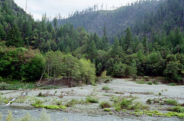 Click on image to enlarge (88K).
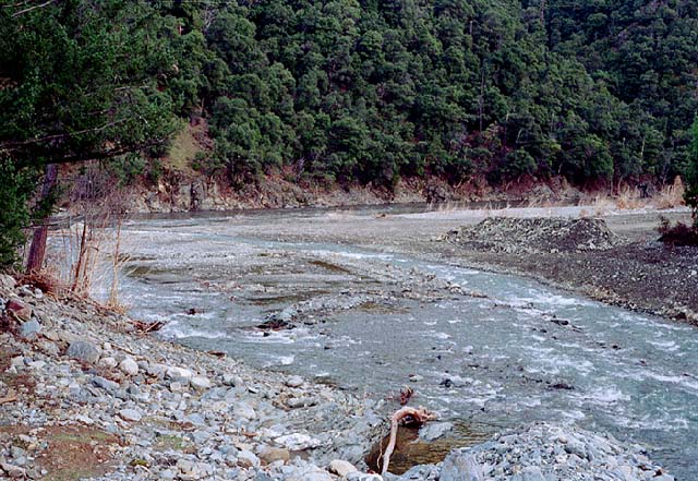 Click on image to enlarge (98K).
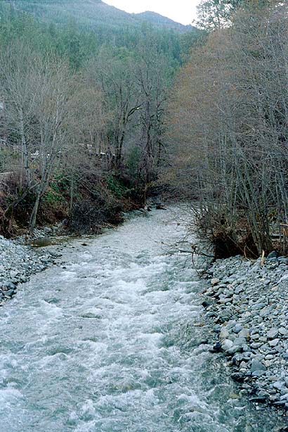 Click on image to enlarge (85K).
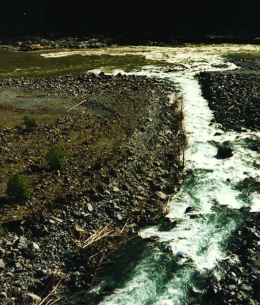 Click on image to enlarge (122K).
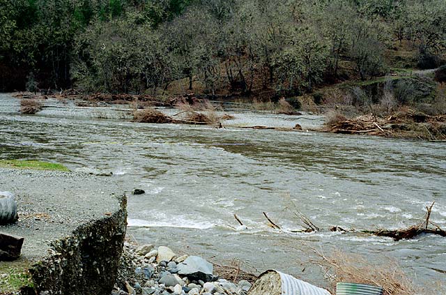 Click on image to enlarge (94K).
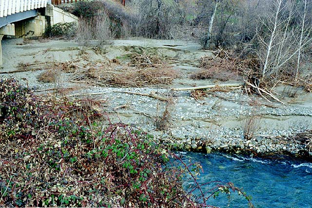 Click on image to enlarge (133K).
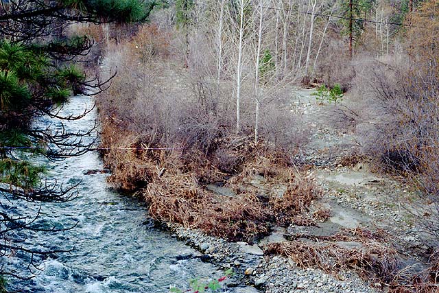 Click on image to enlarge (126K).
To learn more about this topic click Info Links
To view additional information (data source, aquisition date etc.) about this page, click Metadata
| www.krisweb.com |