
| Area | Middle Klamath |
| Topic | Tour: USFS Restoration Structures Indian Cr Mile 6.4 1997 |
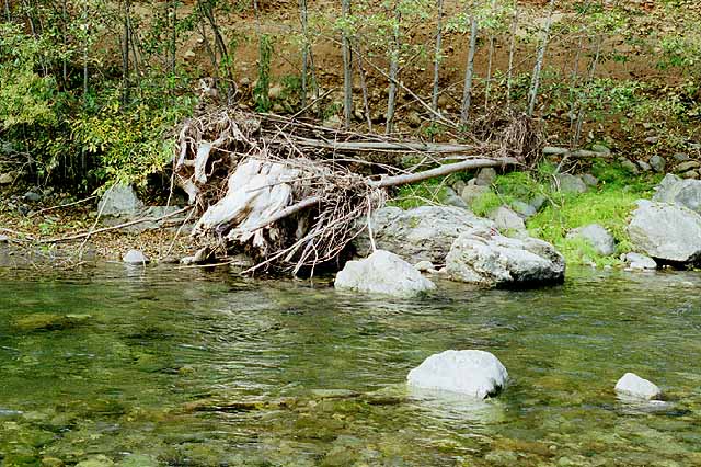
A boulder and large wood structure along the margin of Indian Creek at River Mile 6.4 that survived the January 1997 storm intact. Photo by Pat Higgins taken in September 1997 as part of Klamath Restoration Program Mid-Term Evaluation (see Info Links).
Al Olson, Klamath National Forest fisheries biologist, stands next to a large wood and boulder structure during a September 1997 field reconnaissance tour. The structure in the reach at Mile 6.4 survived the January 1997 storm intact. A substantial flood relief terrace helped to dissipate flood energy at this location, lessening flood damage (see Picture 7). Photo by Pat Higgins taken in September 1997 as part of Klamath Restoration Program Mid-Term Evaluation (see Info Links).
Indian Creek at the Mile 6.4 reach during low flows in September 1997. The large wood structure at right is the same as in Picture #1. Large boulders in the photo that are nearly submerged are part of structures installed by Klamath National Forest. Large flows of January 1997 caused local scour around these (see Picture #3 for close up). Photo by Pat Higgins taken in September 1997 as part of Klamath Restoration Program Mid-Term Evaluation (see Info Links).
Close up of boulder cluster partially submerged at Mile 6.4 on Indian Creek. The local scour has created ideal habitat for rearing juvenile salmonids. Photo by Pat Higgins taken in September 1997 as part of Klamath Restoration Program Mid-Term Evaluation (see Info Links).
Boulder clusters placed by Klamath National Forest in Indian Creek in the Mile 6.4 reach survived the January 1997 storm intact. Scour pockets around boulders provide excellent habitat for yearling steelhead. Photo by Pat Higgins taken in September 1997 as part of Klamath Restoration Program Mid-Term Evaluation (see Info Links).
Klamath National Forest fisheries biologists Bill Beamis (left) and Al Olson pictured during the September 1997 field reconnaissance along Indian Creek. Boulder structures at left seem to be functioning properly and to have survived high flows from the flood in January 1997. Flood relief terrace at Mile 6.4 allowed dissipation of flood energy that lessened flood damage in this reach (see Picture #7). Photo by Pat Higgins taken in September 1997 as part of Klamath Restoration Program Mid-Term Evaluation (see Info Links).
This photo shows a large flood relief terrace of Indian Creek at River Mile 8.4. The large wood jams indicate that this was a major part of the active channel during the January 1997 storm. This large terrace helped to dissipate flood energy at this location, lessening flood damage. Photo by Pat Higgins taken in September 1997 as part of Klamath Restoration Program Mid-Term Evaluation (see Info Links).
 Click on image to enlarge (92K).
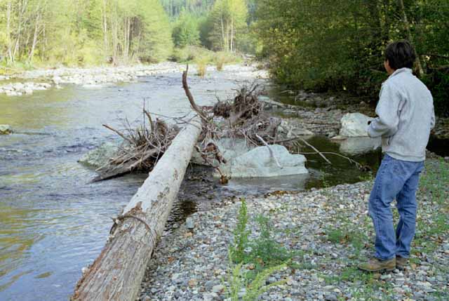 Click on image to enlarge (48K).
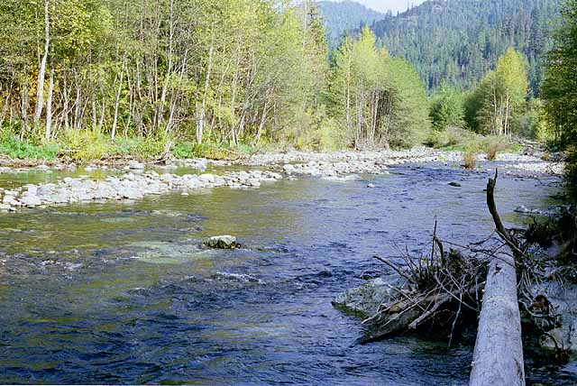 Click on image to enlarge (76K).
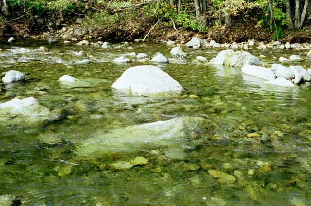 Click on image to enlarge (56K).
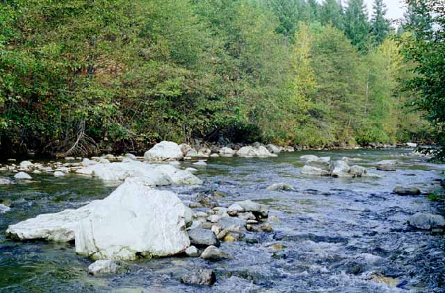 Click on image to enlarge (61K).
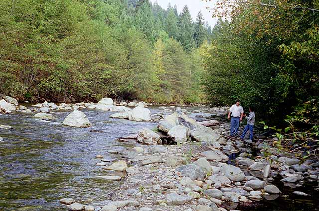 Click on image to enlarge (85K).
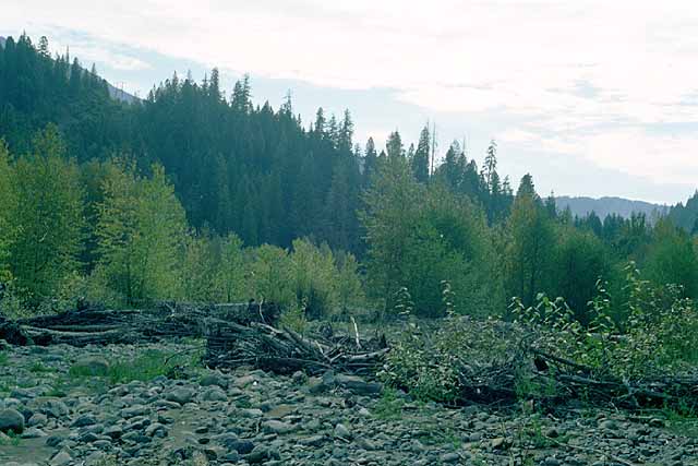 Click on image to enlarge (46K).
To learn more about this topic click Info Links
To view additional information (data source, aquisition date etc.) about this page, click Metadata
| www.krisweb.com |