
| Area | Middle Klamath |
| Topic | Tour: Maps of Karuk Tribe Ancestral Territory |
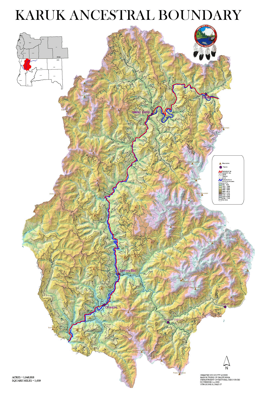
This map shows the location of the Karuk Tribe of California's Ancestral Territory. It is bordered along the Klamath River to the south by Bluff and Red Cap Creek. The northern boundary is along Seiad and Walker Creek. The total acreage for the Ancestral Territory is 1,048,818, of which 97% is currently under the direct management of the Unites States Forest Service.
This map shows the Klamath River sub-basins which are within the Karuk Tribes Ancestral Territory.
This map shows the Klamath Basin with Middle Klamath Sub-Basin highlighted. The Middle Klamath Basin extends slightly into southern Oregon.
This map shows land management within the Mid-Klamath Basin. The Upper portion of the basin is characterized as having a checkerboard pattern, consisting of mostly USFS (Klamath NF), private, and BLM managed lands. This is the result of old railroad land grants, but today the private land is largely in industrial timber ownership. Timber harvest on private lands is occurring at a higher rate than on USFS lands. Within the lower portion of the basin, the majority of land is currently managed by the USFS (Klamath & Six Rivers NF). Private and Tribal Trust Lands are mostly confined to areas along the Klamath River. The Karuk Tribes Ancestral Territory covers almost the entire portion of the lower section of the middle Klamath. The red polygon to the West of the basin is the Siskiyou Wilderness, the polygon to the East represents the Marble Mountain Wilderness.
 Click on image to enlarge (643K).
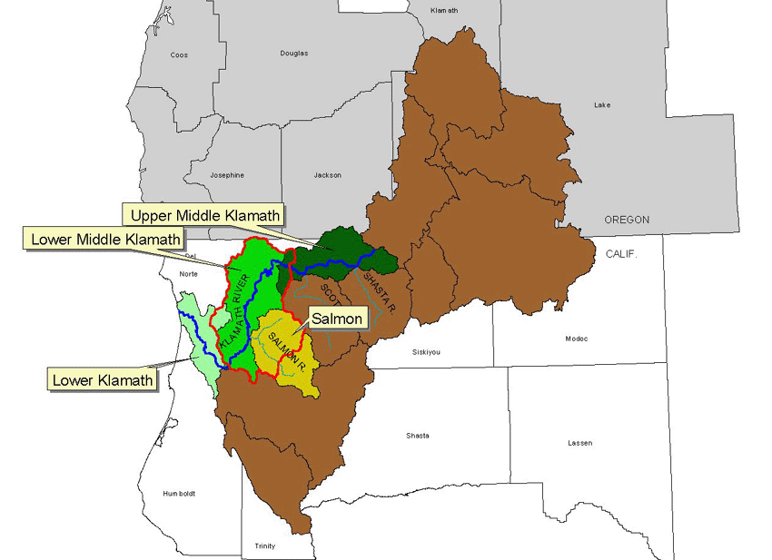 Click on image to enlarge (75K).
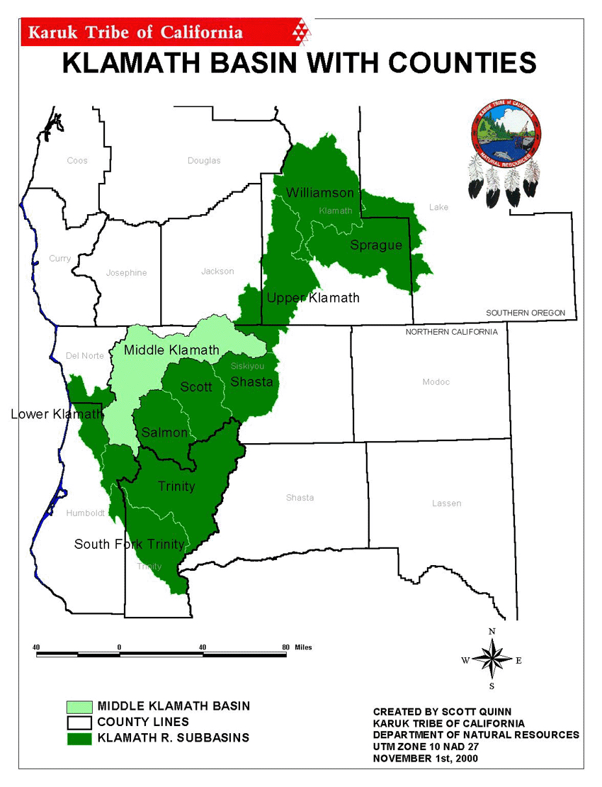 Click on image to enlarge (139K).
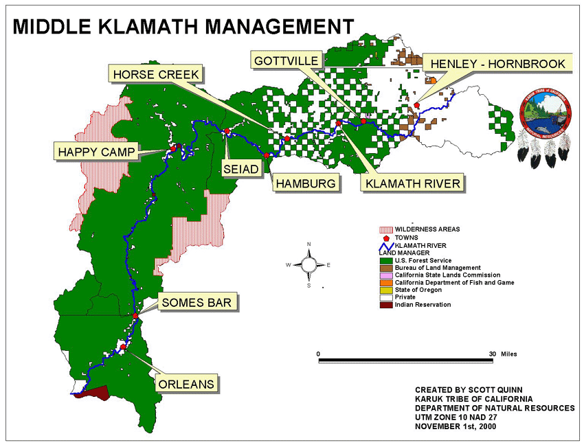 Click on image to enlarge (115K).
To learn more about this topic click Info Links
To view additional information (data source, aquisition date etc.) about this page, click Metadata
| www.krisweb.com |