
| Area | Middle Klamath |
| Topic | Tour: 2002 Photo Points of Camp Creek and Dillon Creek |
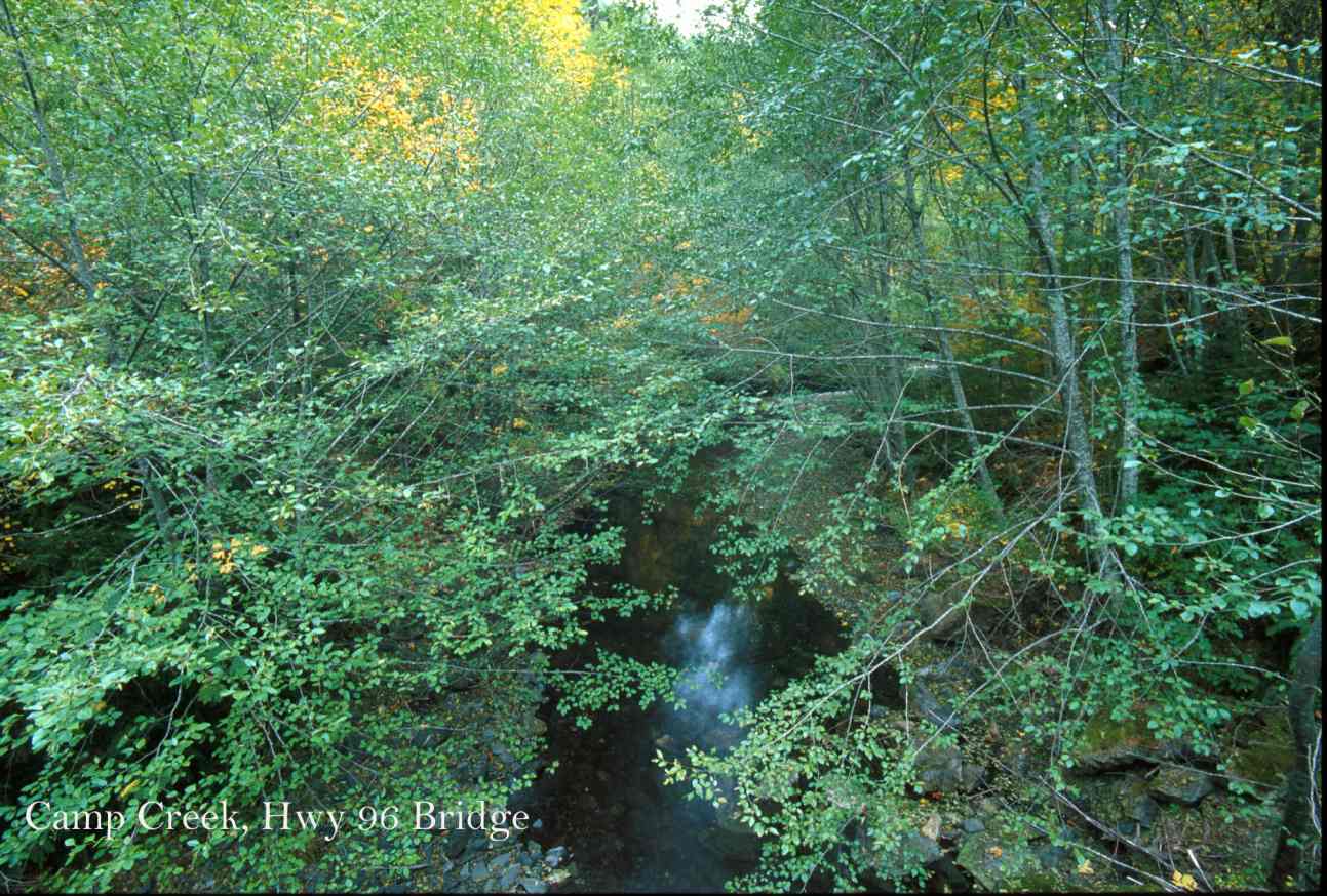
This photo shows Camp Creek at Hwy 96 Bridge. Photo contributed by Michael Hentz. 2002.
This photo shows Camp Creek to the left at its confluence with the Klamath River. Flows are barely visible because of drought conditions. Photo contributed by Michael Hentz. 2002.
This photo shows Camp Creek close up as it joins the Klamath River. Note the large particle size distribution of the gravel bar and the terrace at upper right in the photo, indicating that Camp Creek not depositing or over-supplied with fine sediment. Photo contributed by Michael Hentz. 2002.
This photo shows Camp Creek's middle watershed landscape. The forest has interspersed patch clear cuts that were done by the U.S. Forest Service in the late 1970's and early 1980's. Forest regeneration is poor on some sites as a result of serpentine soils or other limiting factors in ultramafic terrain. The U.S. Forest Service has managed Camp Creek as Key Watershed under the Northwest Forest Plan and it provides habitat for Chinook, coho and steelhead trout. Photo contributed by Michael Hentz. 2002.
This photo shows Dillon Creek at its confluence with the Klamath River. Dillon is noted for its outstanding clarity, which it has maintained despite a large fire in its watershed in 1994. Note the large particle size distribution of the gravel bar to the right of the creek, showing no indication of fine sediment. Photo contributed by Michael Hentz. 2002.
This photo shows a ridge in lower Dillon Creek showing very poor forest health. Marble Mountain shows along the ridge line in the distance. Photo contributed by Michael Hentz. 2002.
This photo shows Dillon Creek at Siskon Mine, which is the discolored area along the ridge at middle distance in the photo. The active, recent fire history of Dillon Creek is apparent as one sees bare ridges where the fire burned very hot in 1994. Preton Peak and the Siskiyou Wilderness Area is in the distance. Photo contributed by Michael Hentz. 2002.
This photo shows Dillon Creek at the USFS camp ground not far above the confluence with the Klamath River. Note the water clarity. Photo contributed by Michael Hentz. 2002.
 Click on image to enlarge (165K).
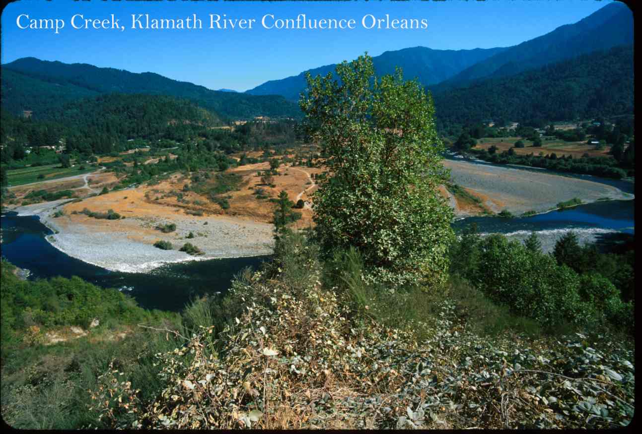 Click on image to enlarge (120K).
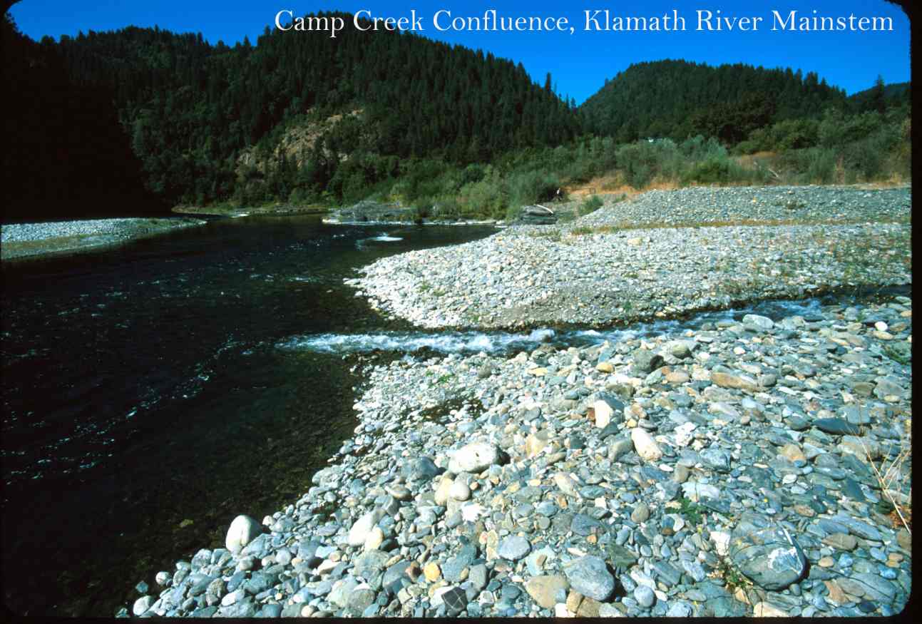 Click on image to enlarge (118K).
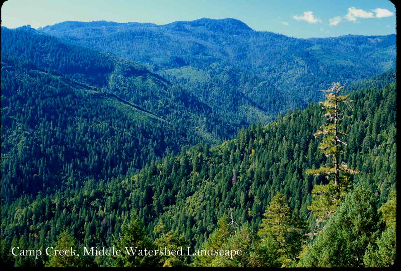 Click on image to enlarge (132K).
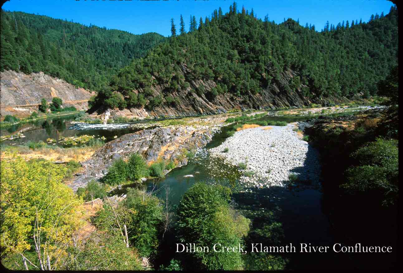 Click on image to enlarge (138K).
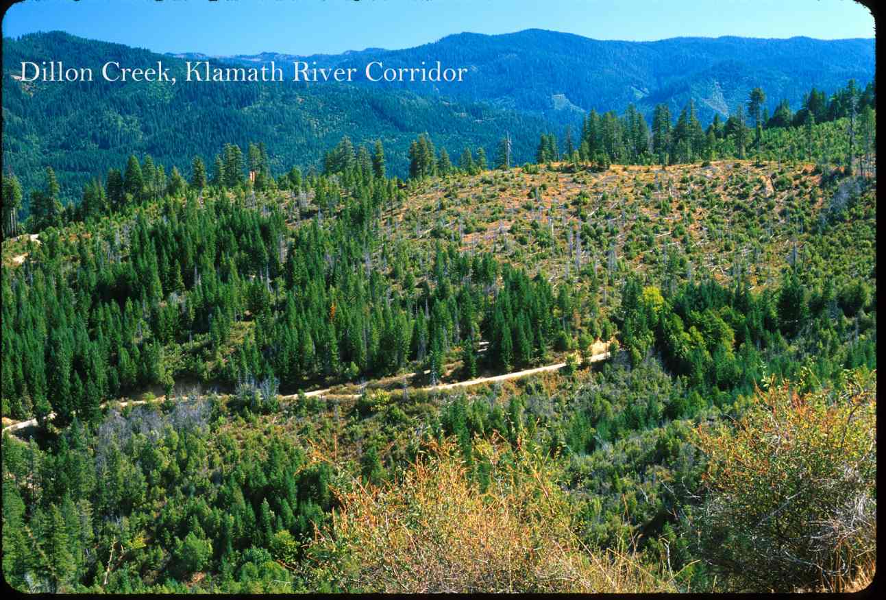 Click on image to enlarge (158K).
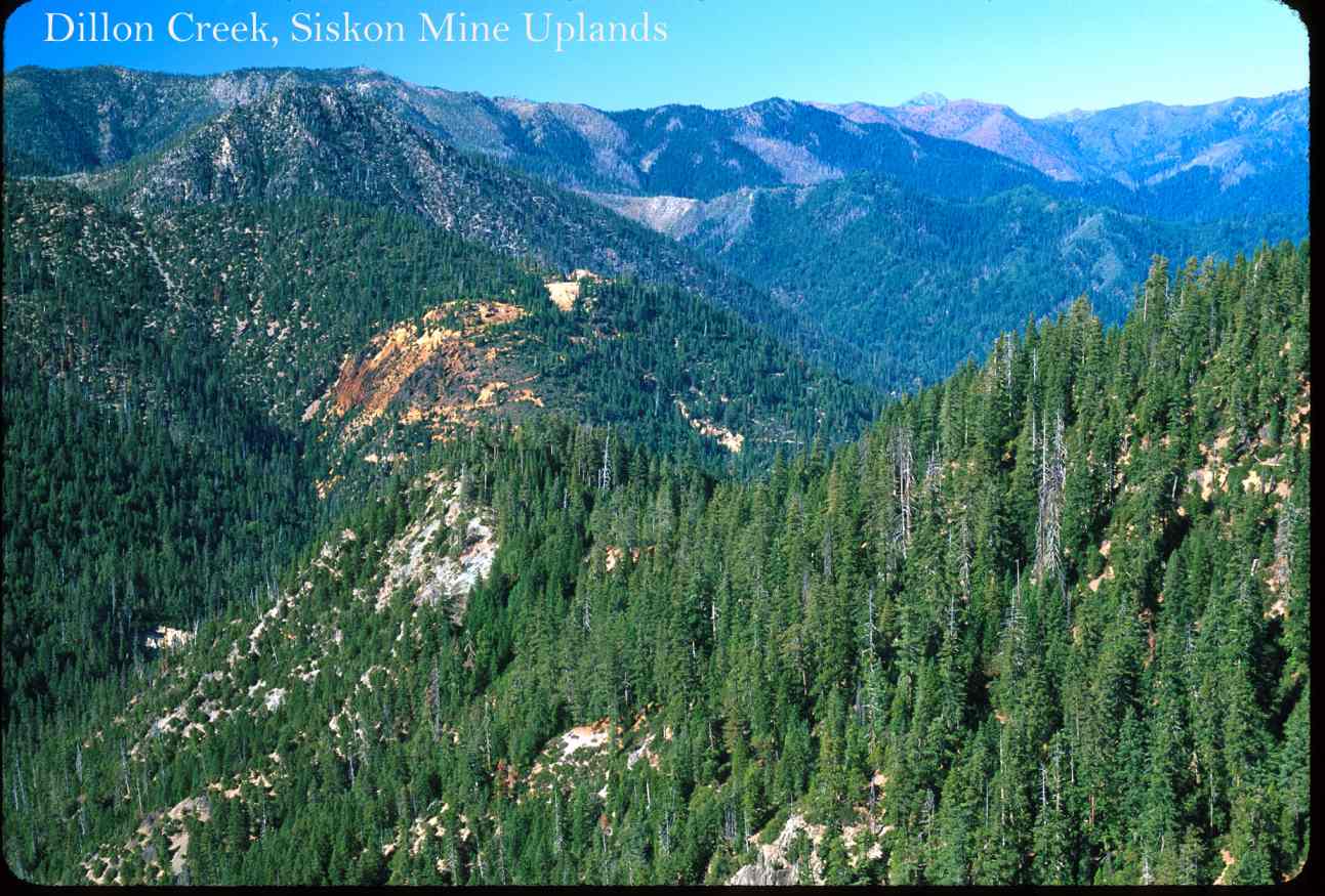 Click on image to enlarge (151K).
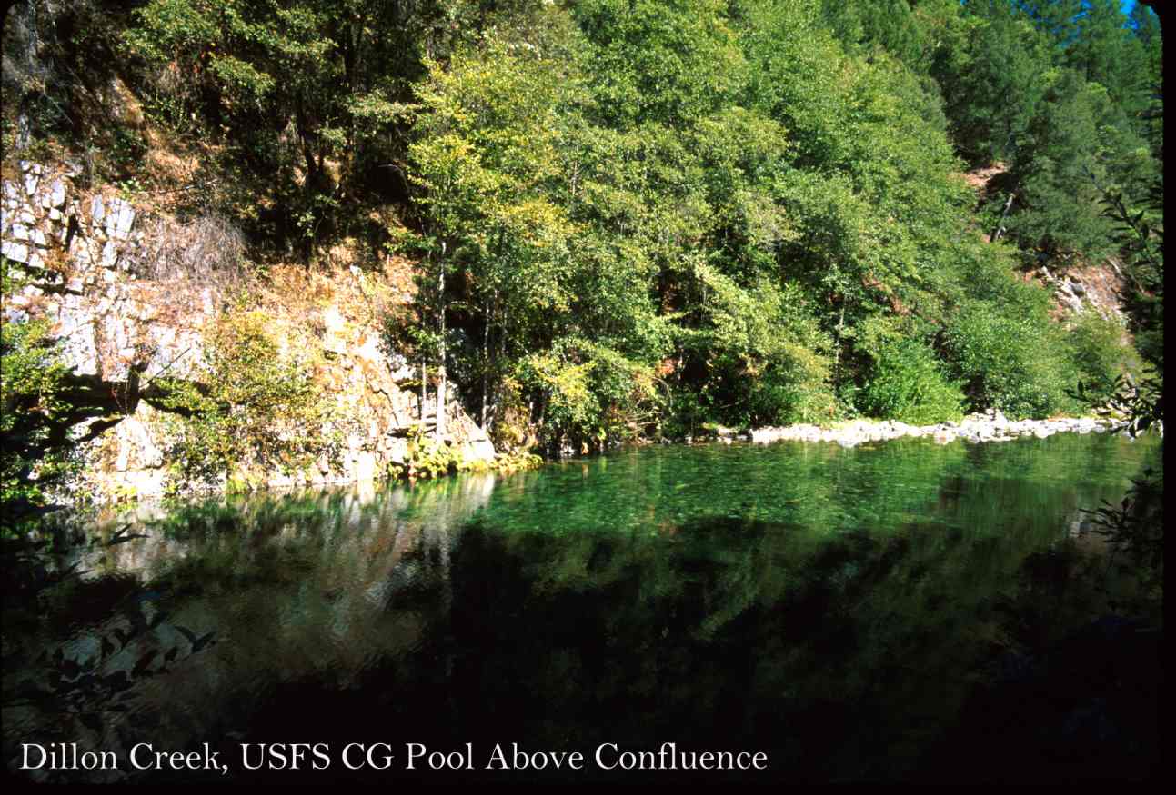 Click on image to enlarge (139K).
To learn more about this topic click Info Links
To view additional information (data source, aquisition date etc.) about this page, click Metadata
| www.krisweb.com |