| Area |
Salmon River |
| Topic |
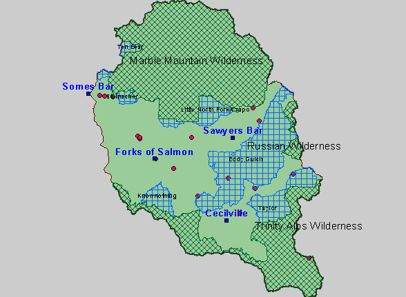
Map: Salmon River Wilderness Areas and LSRs |
|
This is a map of the wilderness areas and Late Successional Reserves in the Salmon River Project Area. Wilderness areas and
Late Successional Reserves (LSRs) take up a large percentage of the area in the Salmon. Forty five percent of the sub-basin is
designated as wilderness. LSRs are areas designated for the protection of wildlife and fisheries under the Northwest Forest Plan.
Use the Pan (hand icon) and Zoom (magnifying glass icons) tools to move around the map.
|
|
|
 |
 |
To view metadata about a map layer, click on a link in the table below.
