
| Area | Salmon River |
| Topic | Map: Salmon River Fish Presence and Water Monitoring |
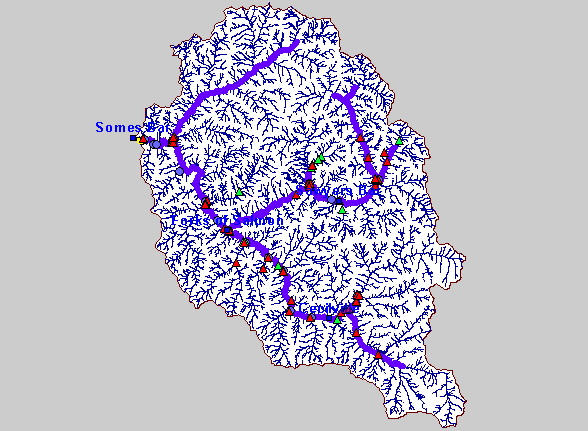
| This is a map of Fish Presence and Water Monitoring Sites in the Salmon River Project Area. 2002 Temperature and Flow Monitoring Stations, and Spring Chinook Presence are shown in the currently displayed layer. | |||
 |
 |
||
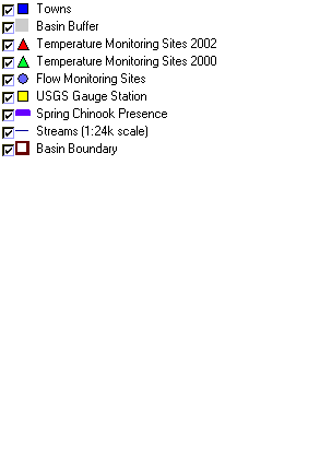
To view metadata about a map layer, click on a link in the table below.
| Name of Layer in Map Legend | Metadata File Name |
|---|---|
| Towns | towns.shp.txt |
| Basin Buffer | buffer_basinboundary.shp.txt |
| Temperature Monitoring Sites 2002 | hobo2002.shp.txt |
| Temperature Monitoring Sites 2000 | hobo00.shp.txt |
| Flow Monitoring Sites | flow_sites.shp.txt |
| USGS Gauge Station | md_gs_utm.shp.txt |
| Spring Chinook Presence | sr_springchinook.shp.txt |
| Streams (1:24k scale) | sa_strms1000.shp.txt |
| Basin Boundary | basin_bnd.shp.txt |
| www.krisweb.com |