
| Area | Shasta |
| Topic | Flow: Shasta River Comparisons 1974,1983,1986 |
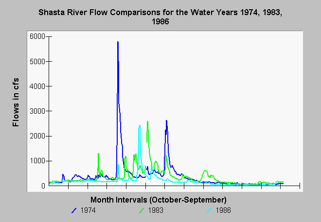
| Caption: The USGS flow records displayed above show flows of the Shasta River for several wet years: 1974, 1983 and 1986. The flood peak in the Shasta River is lessened because of Dwinell Reservoir, which catches water from the upper Shasta River and Parks Creek. Maximum flood peaks in each of these years was approximately 2500 cubic feet per second, except in January 1974 when flows reached 5800 cfs. The X-Axis is delimited at monthly intervals from October of the year prior through September of the water year listed. See Main Klamath Topic Flow: Peak @ 7 Gauges 1964,1974,1997 to see comparison of Shasta flood peaks for 1964, 1974 and 1997 and those at other Klamath Basin locations. | |
 |
To learn more about this topic click Info Links .
To view additional information (data source, aquisition date etc.) about this page, click Metadata .
To view the table with the chart's data, click Chart Table web page.
To download the table with the chart's data, click 3090.dbf (size 233,632 bytes) .
| www.krisweb.com |