
| Area | Shasta |
| Topic | Tour: Shasta Historical Photos |
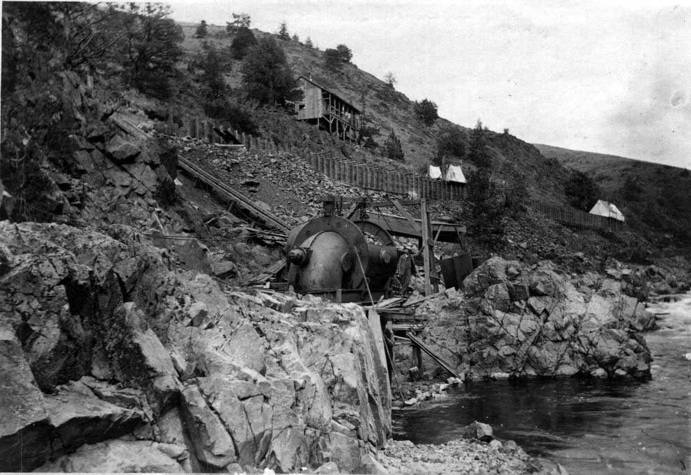
This photograph is of the Prather pump under construction in the Shasta River gorge in 1893. Water was diverted from the Shasta River about ˝ mile upstream (now the Dewey Smith Diversion Dam) and run through the flume at the top of the photo, which was nearing completion at the time of the photo. The water ran through a water motor driving a pump which lifted a much smaller quantity of water several hundred feet up the hill., where it was put into a ditch that ran almost all the way to Montague.
Inside the flume leading to the Prather pump just after it was completed in 1893.
This historical photograph of the Shasta River was taken from the railroad bridge during a major flood early in the century. The exact date of the photo is unknown. Photos such as this from known locations can help understand Shasta River riparian conditions at different times in the past (see also sh4336.jpg, looking at the same area during the flood of 1997).
Photo taken of the Montague/Grenada Road Bridge and the Shasta River prior to 1948. There are indications of fairly heavy grazing in the riparian zone at the time of the photo. It was likely taken in the late 1930's or early 1940's.
Mouth of the Shasta River with salmon fishermen circa 1953. The mouth of the Shasta River was an extremely effective place for salmon angling but was closed to fishing in the 1990's to protect Shasta fall Chinook stocks.
The old Shasta Racks on the Dewey Smith property at the top of the Shasta gorge, circa 1953.
This photo shows the USGS gauging station on the lower Shasta River in 1953. The white shed adjacent to the stream houses the gauge. Note the lack of vegetation and check Picture #8 to see recovery.
This black and white photo was taken in 1996 at the same location as Picture #7 and shows considerable riparian recovery from the 1953 photo. Note that the white USGS gauging station shed is barely visible through the trees near the telephone pole at center right. Joe Valcazar, the property owner at the time is pictured at left.
 Click on image to enlarge (103K).
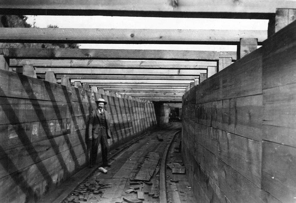 Click on image to enlarge (74K).
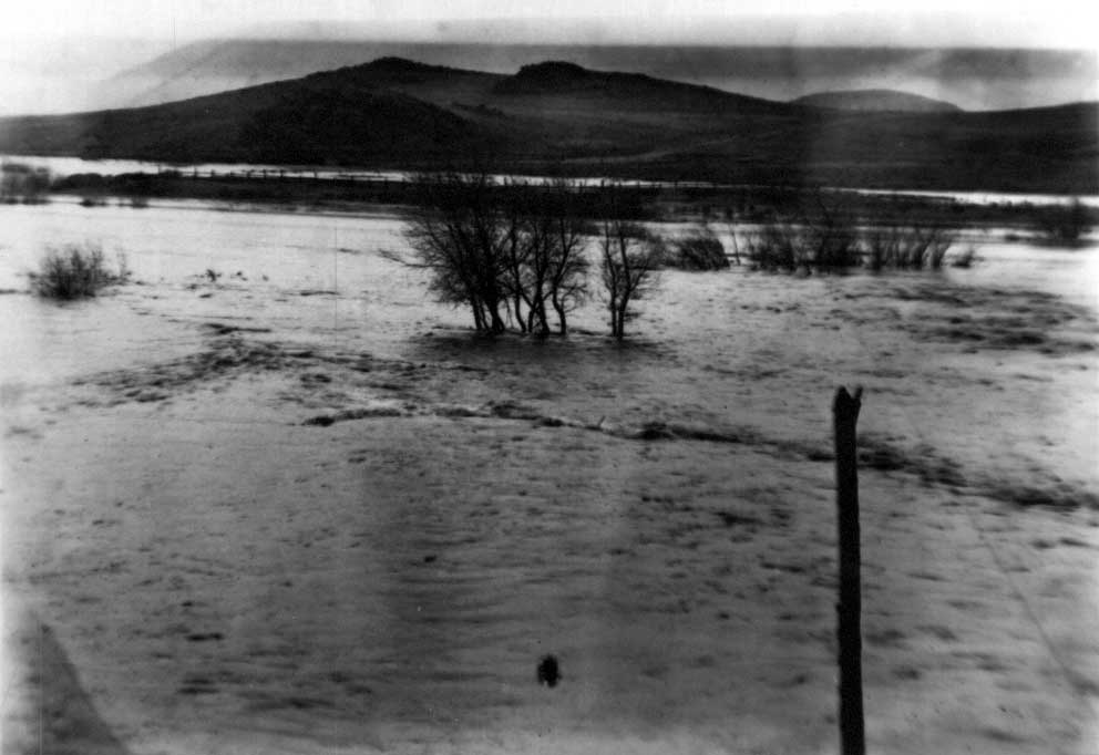 Click on image to enlarge (51K).
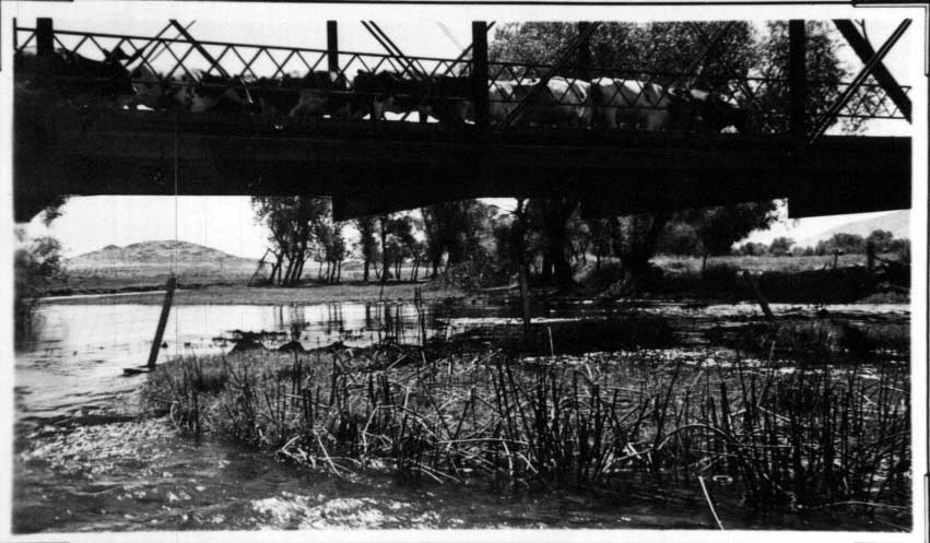 Click on image to enlarge (65K).
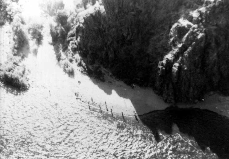 Click on image to enlarge (41K).
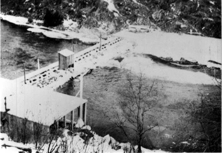 Click on image to enlarge (50K).
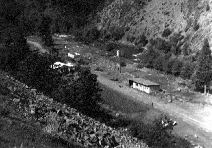 Click on image to enlarge (61K).
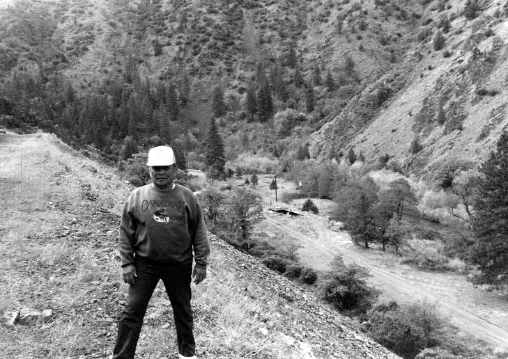 Click on image to enlarge (80K).
To learn more about this topic click Info Links
To view additional information (data source, aquisition date etc.) about this page, click Metadata
| www.krisweb.com |