
| Area | Shasta |
| Topic | Tour: Shasta Valley Aerial Photos |
This aerial photo shows the convergence of Big Springs Creek and the Shasta River. Big Springs Creek flows from springs which are fed by snow melt through underground aquifers. The Shasta River's flow is restricted by Dwinell Dam which upstream and out of the photo to the right.
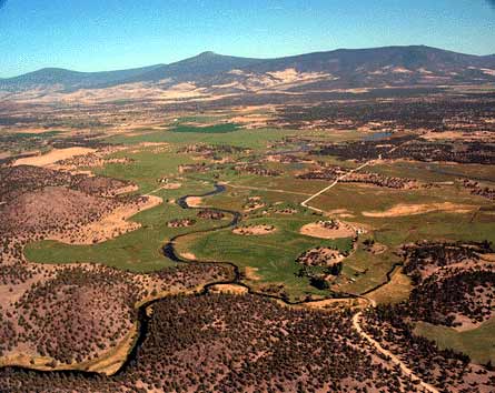
This photo shows the convergence of Big Springs Creek and the Shasta River at the bottom-center of the photo. The lake near the center of the photo is an off-stream storage impoundment which is fed by water extracted from Big Springs Creek.
This aerial photo shows Big Springs Creek just downstream of its origin. The picture shows cattle in the stream and in adjacent irrigated wetlands. Significant quantities of irrigation tailwater are visible returning to the stream. A 1984 Department of Water Resources report (see Clawson et al., 1984 in KRIS Bibliography) noted that this was one of the prime spawning areas for Chinook salmon in the Shasta River basin.
This photo shows the Shasta River meandering through agricultural lands in the vicinity of Grenada. Mt Shasta and Black Butte (the smaller volcano) are both visible in the distance. The hummocks on the valley floor below Shasta and Black Butte are the result of a gigantic debris torrent that occurred (see Crandall, 1989 in KRIS Bibliography).
This photo shows the convergence of Parks Creek and the Shasta River below center and to the left. The very small Shasta Spring Creek joins the Shasta at far right-center of the photo.
This aerial photo shows the Shasta River downstream of the Montague-Grenada Road Bridge. Note changes in the riparian condition along the Shasta that changes abruptly at property boundaries.
The lower Shasta River runs through a gorge, which is shown in the aerial photo above. Highway 263 winds through the photo from the lower-middle area and extends north (to the center of the picture). Interstate 5 is at upper right.
 Click on image to enlarge (34K).
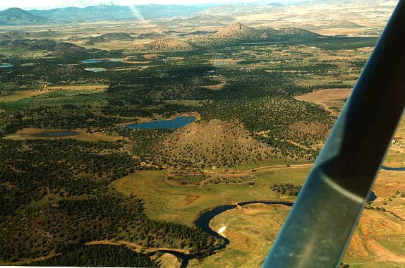 Click on image to enlarge (56K).
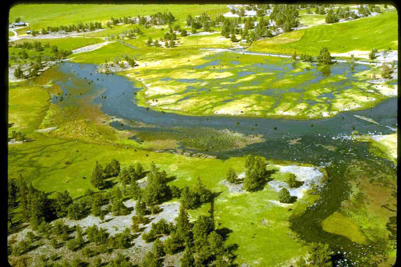 Click on image to enlarge (146K).
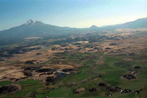 Click on image to enlarge (20K).
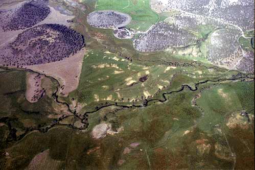 Click on image to enlarge (30K).
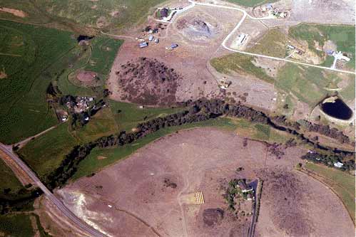 Click on image to enlarge (27K).
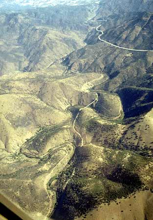 Click on image to enlarge (29K).
To learn more about this topic click Info Links
To view additional information (data source, aquisition date etc.) about this page, click Metadata
| www.krisweb.com |