
| Area | Shasta |
| Topic | Tour: Shasta River Basin Map Tour |
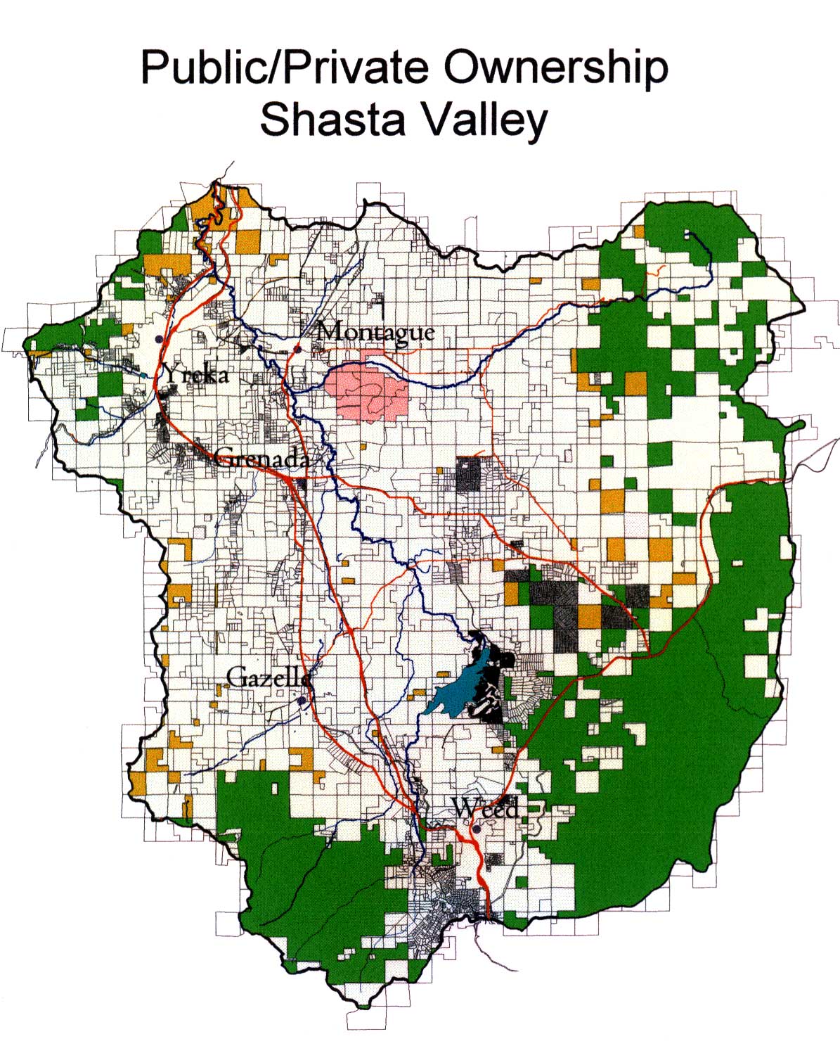
The Shasta CRMP restoration coordinator Dave Webb composed the map above in ArcView. The view shows ownership, parcels and main roads. The green is National Forest lands with Shasta Trinity National Forest in the southern part of the basin (lower) and the Klamath National Forest to the east and west. Most of the Shasta Valley is in private ownership, which is displayed in white. The orange polygons are Bureau of Land Management Ownership. Siskiyou County provided the parcel ownership information shown.
The map above shows the response to a landowner survey related to cooperation in restoration projects. The map was put together for planning purposes for the Shasta Coordinated Resources Management and Planning (CRMP) group. Special ArcView project created by Dave Webb.
The map image above shows soil erodibility for the Shasta Valley with greater erosion risk in areas heavily used for agriculture. Much of the highly erodible area is in the track of a large debris torrent, which swept down the valley as an ancient volcano liquefied near the present location of the town of Weed (see Picture #5). This map is from the Shasta KRIS Map project but is originally from NRCS and is at a 1:250,000 scale.
This map of rainfall isopleths shows that rainfall in the middle of the Shasta Valley falls to an amazingly low 5 inches annually. Rainfall and snowfall on Mt Shasta reach 60-70 inches. Rainfall is higher to the east and the west of the valley in the Cascades and Klamath Mountains, respectively. Map composition by Dave Webb, Shasta CRMP coordinator.
The Shasta Valley geomorphology is profoundly affected by an ancient debris torrent, the track of which is shown above. A large volcano the size of Mt Shasta liquefied during an eruption and the mountain collapsed on itself and flowed north down the Shasta Valley (see Crandall, 1989 in KRIS Bibliography Shasta section).
This orthophoto quad is taken from the KRIS Shasta Map ArcView project and shows hummocks and hills, which are the result of the ancient debris torrent. I-5 is visible in the far left, lower corner of the picture. The Shasta River is shown in blue and runs south (bottom) to north and is joined by Big Springs Creek just below center. Croplands can be seen at upper right and stock water and irrigation ponds can be seen as dark polygons. Original source of the orthophoto is the US Geologic Survey. Orthophotos are compressed using Mr. Sid to allow for easier use. Use Zoom and Pan functions to explore this detailed photo (click F1 for Help).
The image above is unclassified Landsat imagery from 1994 provided by Humboldt State University for use in the KRIS Shasta Map project. Mt Shasta shows strikingly in red and yellow in the southern (lower) portion of the Shasta Valley. Agricultural lands show in light green. Coniferous forests in the Klamath Mountains to the west and the Cascade Range to the east show in darker greens.
The map above shows the holding pools in the Klamath River below the mouth of the Shasta River versus the area closed to angling for fall Chinook salmon. Dave Webb, Shasta CRMP Coordinator, published this map to convey concern to the California Department of Fish and Game regarding the sufficiency of the area closed to angling. While the area immediately adjacent to the mouth is closed, fall Chinook are likely holding in pools downstream and are, therefore, may still subject to angling pressure.
 Click on image to enlarge (286K).
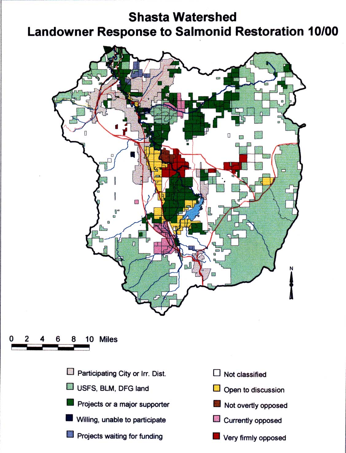 Click on image to enlarge (176K).
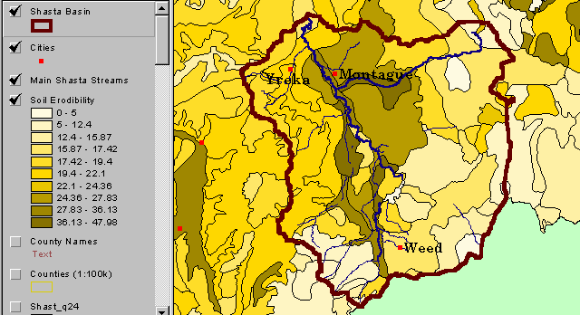 Click on image to enlarge (23K).
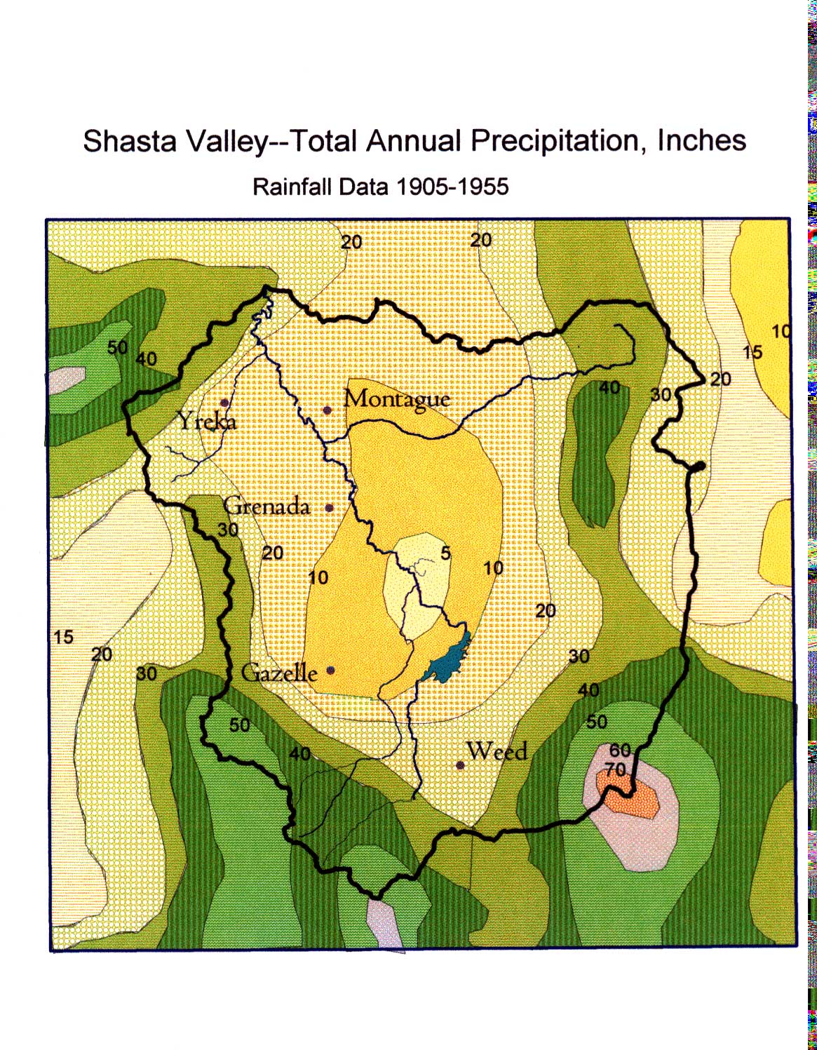 Click on image to enlarge (353K).
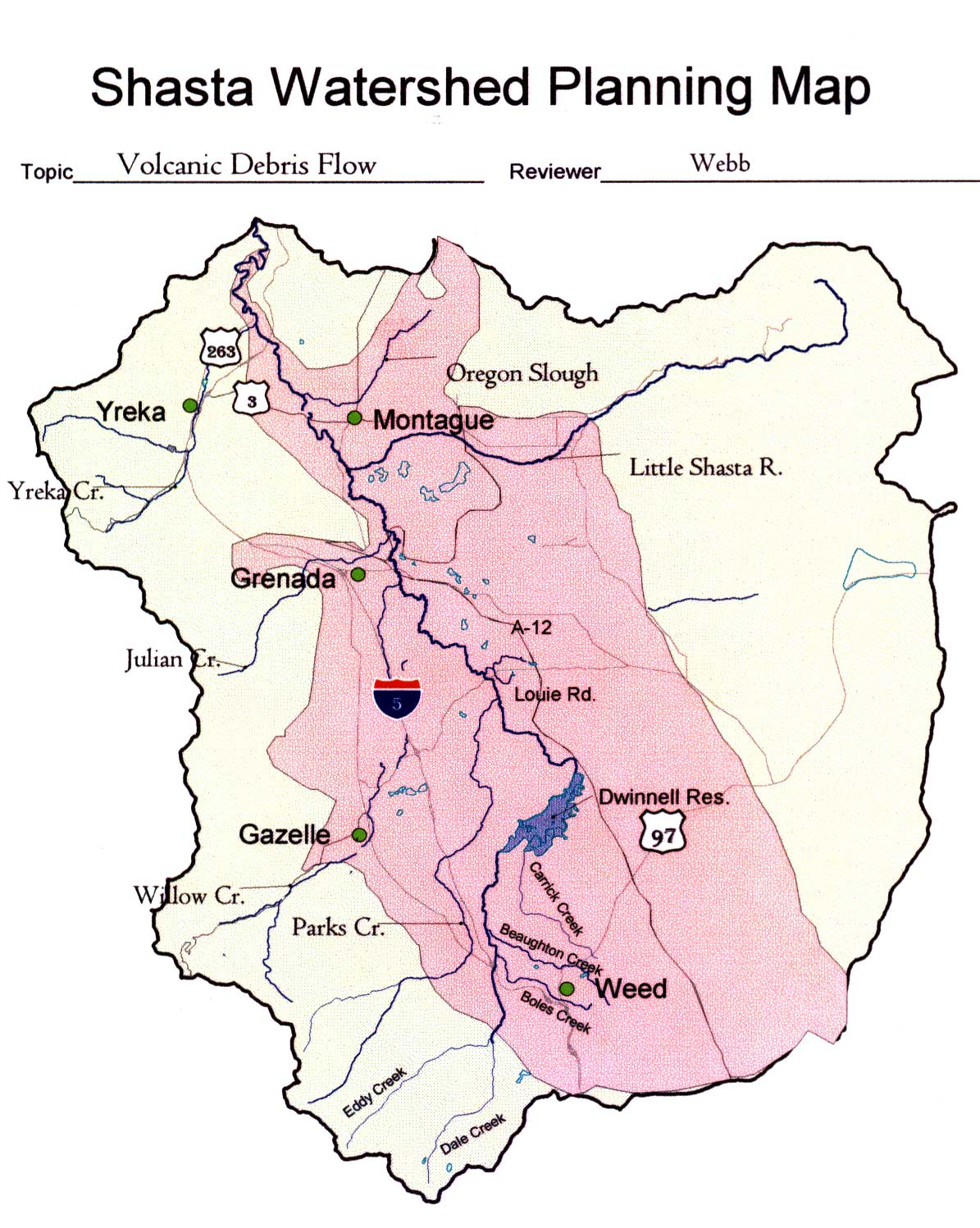 Click on image to enlarge (235K).
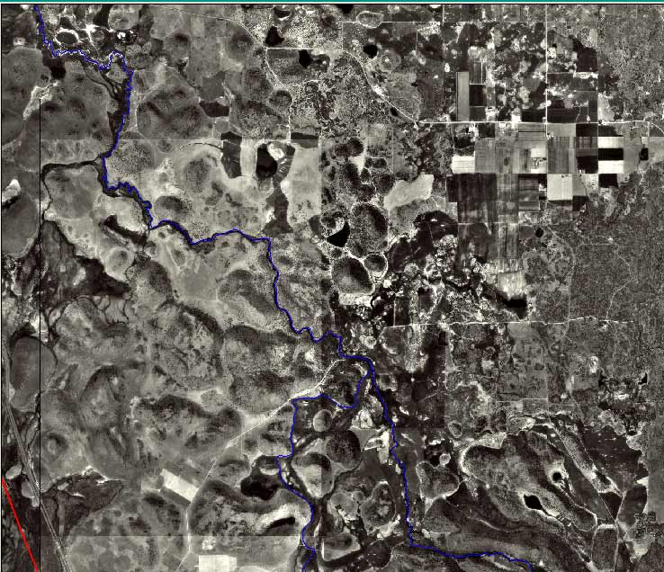 Click on image to enlarge (105K).
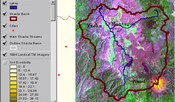 Click on image to enlarge (140K).
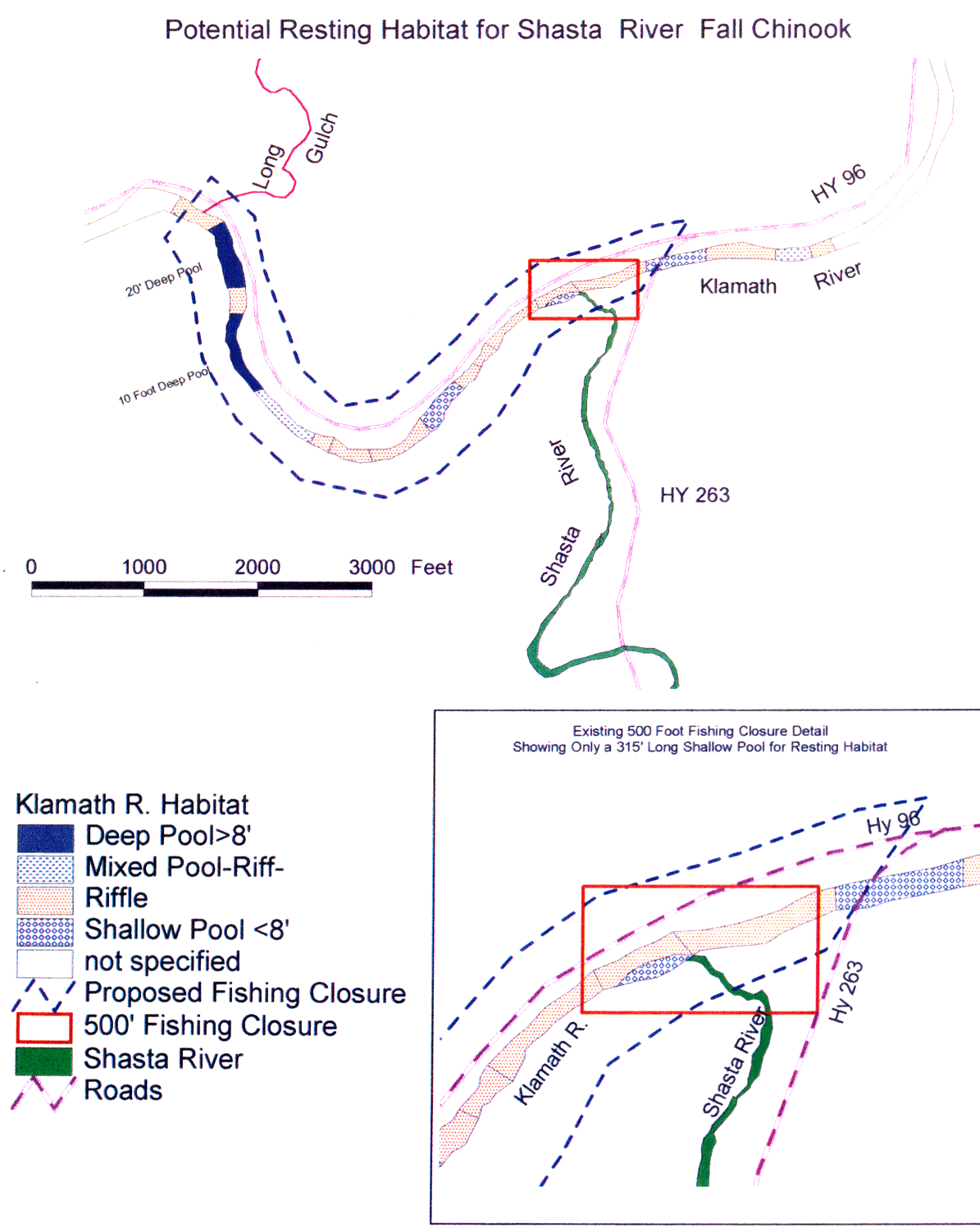 Click on image to enlarge (189K).
To learn more about this topic click Info Links
To view additional information (data source, aquisition date etc.) about this page, click Metadata
| www.krisweb.com |