
|
Area/Topic | Bibliography | Background | Hypotheses | Home |
|
Map Page.
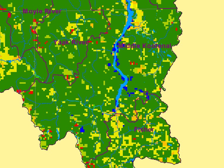
You selected the area Middle Kootenai and the topic Map: D. Landcover, Middle Kootenai - Montana |
| This is a map of landcover, rivers, streams, and lakes in the Montana portion of the Middle Kootenai sub-basin. The basin in Montana is largely coniferous forest with patches of deciduous forest, agriculture, shrubs and grasslands. Mixed forest (Broadleaf and Needleleaf) or Broadleaf Deciduous can in some cases represent early seral conditions following timber harvest. Scale = 1:751,664 . | |||
|
|
||
| www.krisweb.com |