

|
Area/Topic | Bibliography | Background | Hypotheses | Home |
|
Map Page.
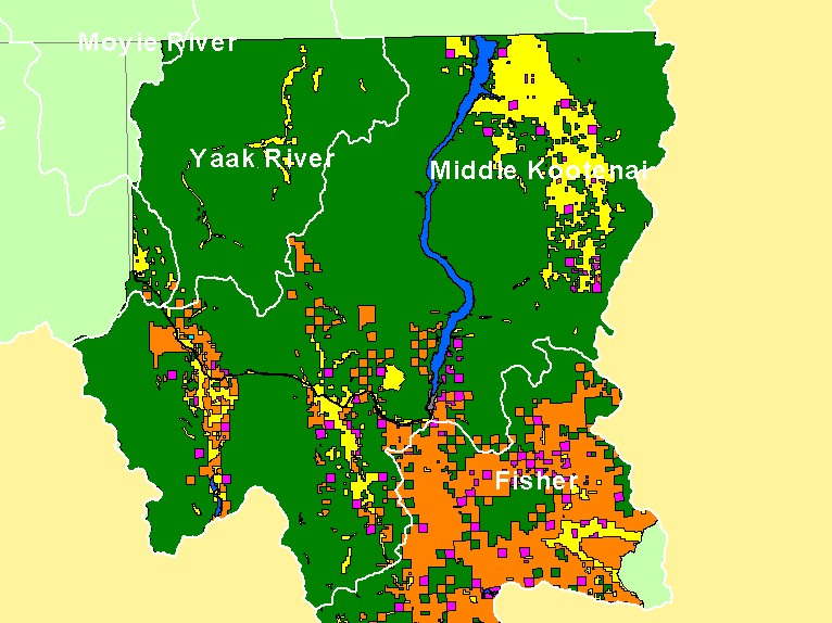
You selected the area Middle Kootenai and the topic Map: E. Land Ownership, U.S. Kootenai River Basin |
| This is a map of land ownership in the Montana portion of the Middle Kootenai sub-basin includes a great deal of U.S. Forest Service lands. Plum Creek Timber Company also has significant ownership in the Middle Kootenai sub-basin (orange), although it owns a much higher percentage of the Fisher River watershed. Data were provided by Kootenai National Forest. Scale = 1:751,664 . | |||
|
|
||
| www.krisweb.com |