
|
Area/Topic | Bibliography | Background | Hypotheses | Home |
|
Map Page.
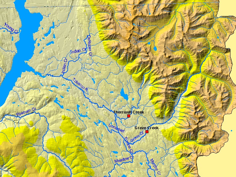
You selected the area Middle Kootenai and the topic Tour: Grave Creek Restoration Riparian Projects |
| This is a map of the U.S. Fish and Wildlife Service, Partners for Fish and Wildlife Program (USFWS) restoration sites in the Tobacco River watershed, displayed on top of hydrography and a digital elevation model. Restoration points (red squares) are hotlinked to photo tours. To view a photo tour, click on a red square. Scale = 1:194,454 . | |||
|
|
||
| www.krisweb.com |