|
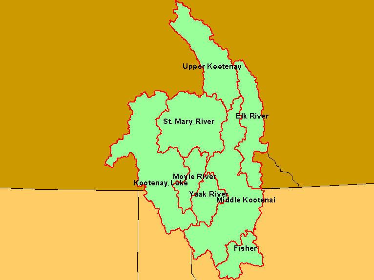
This is a map of the sub-basins in the Kootenai River basin used for the purpose of organization in the pilot KRIS Kootenai River project. Basin boundaries conform to
4th field hydrologic unit code (HUC) watersheds from the U.S. Geologic Survey in the U.S. and similar watersheds in Canada created by the Rocky Mountain Data
Consortium. The original name for the largest sub-basin was Bull River, which has been changed to Middle Kootenai for clarity. These basins may be reconfigured when
a fully funded KRIS Kootenai project goes forth. Data provided by the Kootenai River Network. Scale = 1:2,512,023 .
|
|