
|
Area/Topic | Bibliography | Background | Hypotheses | Home |
|
Map Page.
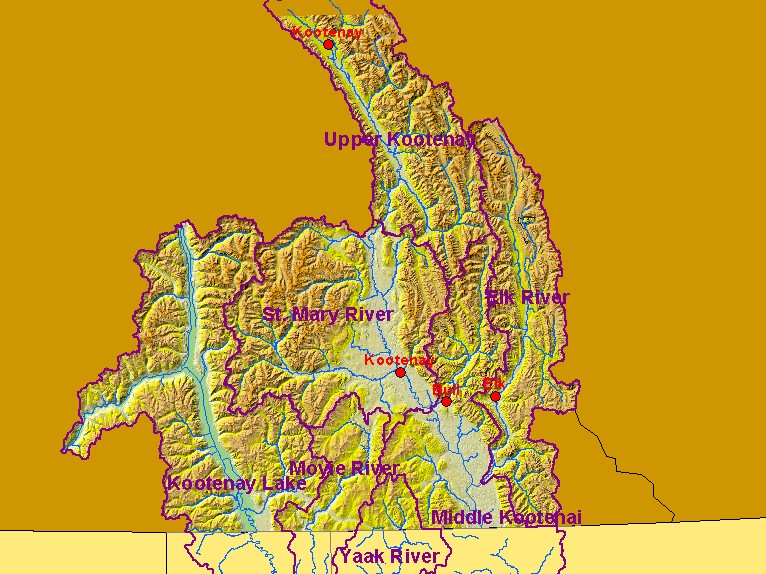
You selected the area Basin-wide and the topic Map: 3. Stream Gage Locations (Hotlinked), Canada Kootenai R. Basin |
| This is a map of rivers, streams, stream gauges in the Canadian portion of the Kootenai River basin. The stream gauges (red dots) are hotlinked to charts of stream flow data. To view a chart, click on the desired location. Data were provided by the Kootenai River Network, Water Survey of Canada, and the Interior Columbia Basin Ecosystem Management Project. Scale = 1:1,627,586 . | |||
|
|
||
| www.krisweb.com |