
|
Area/Topic | Bibliography | Background | Hypotheses | Home |
|
Map Page.
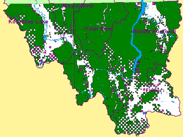
You selected the area Basin-wide and the topic Map: 5. Land Ownership, U.S. Kootenai River Basin |
| This is a map of land ownership in the United States portion of the Kootenai River basin showing significant U.S. Forest Service lands as indicated by the green color. State land is highlighted in pink and private land shows in white. Data were provided by the U.S.F.S. Interior Columbia Basin Ecosystem Management Project. Scale = 1:830,520 . | |||
|
|
||
| www.krisweb.com |