
|
Area/Topic | Bibliography | Background | Hypotheses | Home |
|
Map Page.
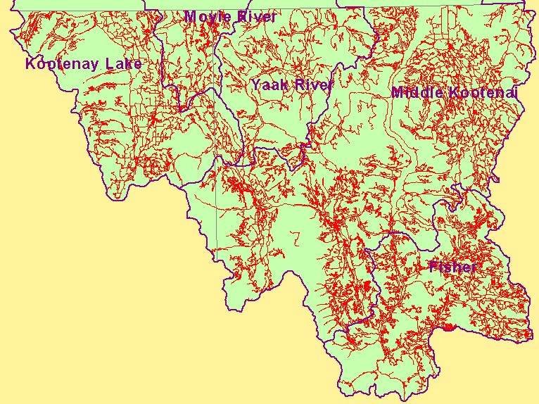
You selected the area Basin-wide and the topic Map: 6. Roads, U.S. Kootenai River Basin |
| This is a map of 1:100,000 scale roads in the U.S. portion of the Kootenai River basin. Data at this scale mostly represents larger roadways and, therefore, substantially underestimate road density. Road density information is useful in watershed analysis because roads can be a major contributor of sediment to streams. Data were provided by the U.S.F.S. Interior Columbia Basin Ecosystem Management Project. Scale = 1:830,520 . | |||
|
|
||
| www.krisweb.com |