
|
Area/Topic | Bibliography | Background | Hypotheses | Home |
|
Map Page.
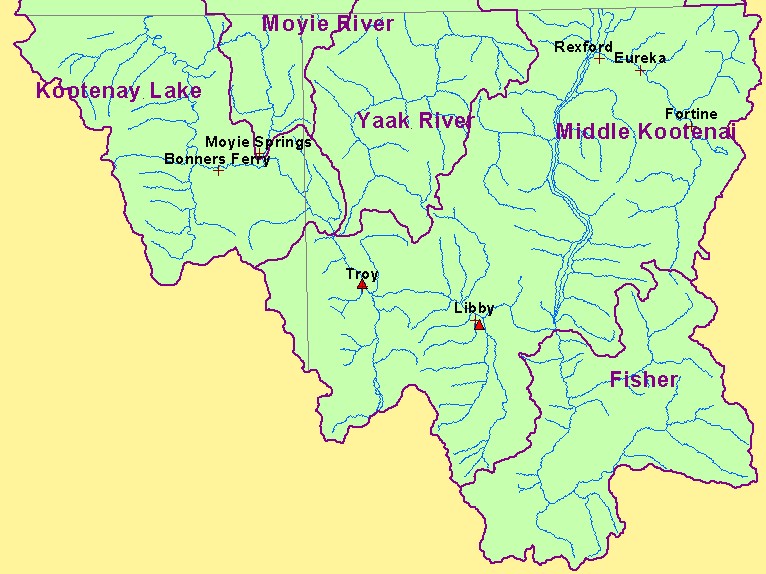
You selected the area Basin-wide and the topic Map: 9. Superfund Water Pollution Sources, U.S. Kootenai River Basin |
| This is a map of Superfund (CERCLA) water pollution sites and a 1:100,000 scale stream map for the U.S. portion of the Kootenay River basin. The two Superfund sites were near the towns of Libby and Troy, Montana. Data were provided by the U.S.F.S. Interior Columbia Basin Ecosystem Management Project. Scale = 1:830,520 . | |||
|
|
||
| www.krisweb.com |