
| Area | Kootenay Lake |
| Topic | Climate: Air Temperature - Bonner's Ferry, ID - Monthly Min, Mean, Max |
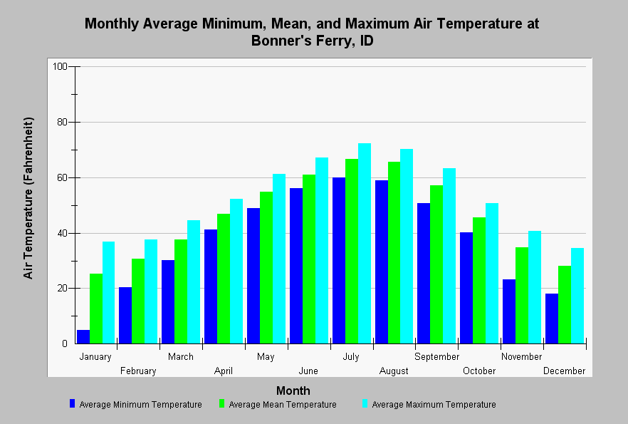
| Caption: This chart shows monthly average minimum, mean, and maximum temperatures at Bonner's Ferry, ID. Average temperatures are near or below freezing between November through March and are highest during July and August. Air temperatures are calculated from data from the National Climatic Data Center and extending from 1907 to 2002. See Info Links for more information. | |
 |
To learn more about this topic click Info Links .
To view a table of information about this data click Metadata .
To view the table with the chart's data, click Chart Table web page.
To download the table with the chart's data, click climate_air_temp_monthly_bonnersferry_id.dbf (size 606 bytes) .
To view the table with the chart's source data, click Source Table web page.
To download the table with the chart's source data, click climate_air_temp_bonnersferry_id.dbf (size 11,778 bytes)
| www.krisweb.com |