
| Area | Kootenay Lake |
| Topic | Flow: Annual Peaks - Kootenai River at Leonia, ID - 1929-2001 |
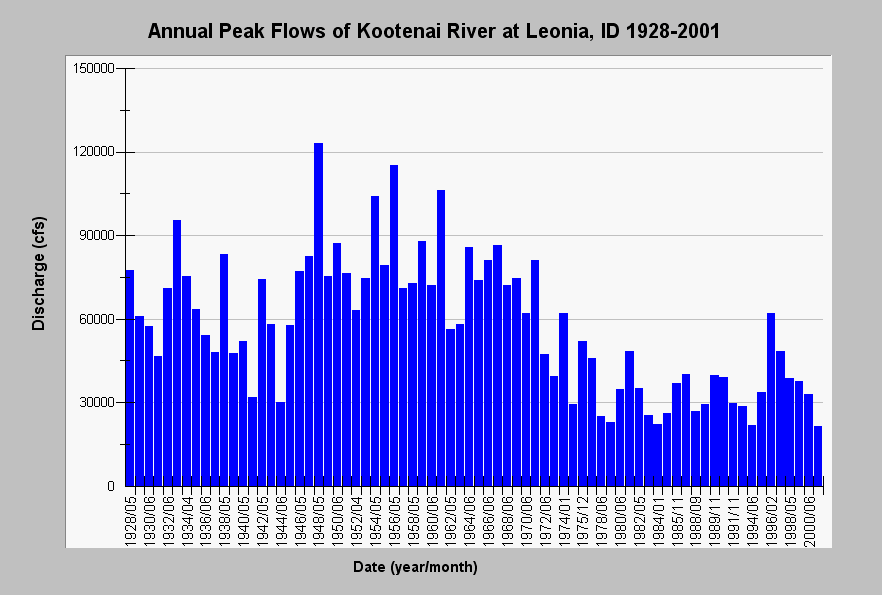
| Caption: This chart displays annual peak discharge measured at Leonia, ID between 1928 and 2001. Annual peak flows are observed between April and June prior to the construction of the Libby dam in 1992. After dam construction, annual peak flows decrease in magnitude and occur during late fall and in winter months. Flow mitigation after 1991 attempts to re-establish peak flow magnitudes and re-time annual peaks to the summer months (Paragamian, et al, 2001) show as a somewhat increased flow regime. Annual peaks were measures at USGS gage # 12305000. See Info Links for more Information. | |
 |
To learn more about this topic click Info Links . .
To view the table with the chart's data, click Chart Table web page.
To download the table with the chart's data, click flow_annual_peaks_kootenai_usgs12305000.dbf (size 2,128 bytes) .
| www.krisweb.com |