
| Area | Basin-wide/Regional |
| Topic | Fish: Electrofishing at 24 Mattole Stations, 1972, Salmonid Density |
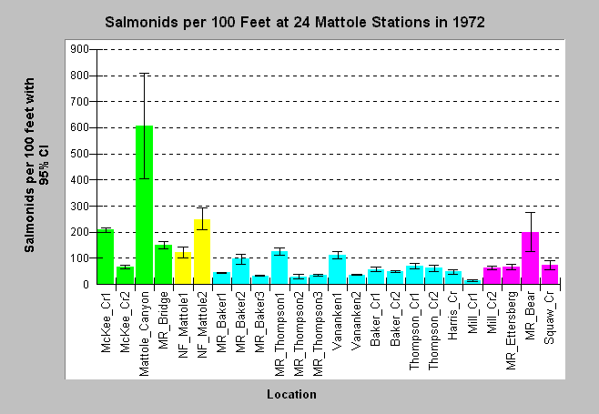
| Caption: Electrofishing of the Mattole River and its tributaries was carried out at 24 stations in 1972. The chart above shows the number of salmonids per 100 feet of stream with a 95% confidence interval. Colors denote sub-basins with green for Mattole East, yellow for Mattole North, blue for Mattole South and pink for Mattole West. The highest fish density was found in Mattole Canyon Creek. The North Fork, McKee Creek and Mattole River near Bear Creek also had relatively high fish density. See the Chart Table to see a full key to locations. See Info Links for more information. | |
 |
To learn more about this topic click Info Links .
To view a table of information about this data click Metadata .
To view the table with the chart's data, click Chart Table web page.
To download the table with the chart's data, click fish_brown_mattole_1972.dbf (size 4,410 bytes) .
| www.krisweb.com |