
| Area | Basin-wide/Regional |
| Topic | Fish: Salmon Redds per Mile by Reach, 1994-2000 |
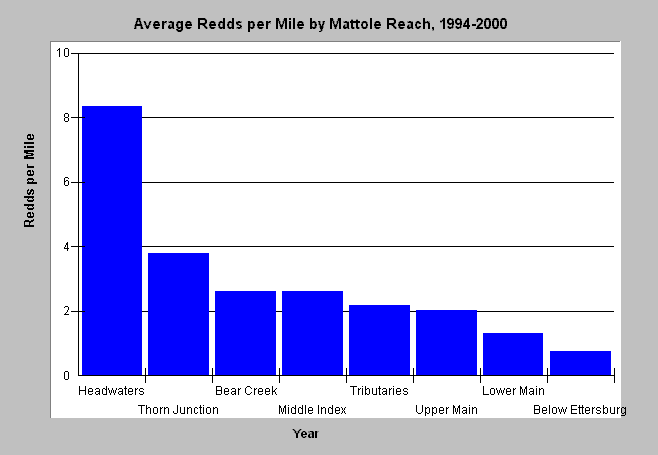
| Caption: The chart above shows the average salmon redds per mile for all eight spawning survey reaches in the Mattole basin over six years. The redds counted are predominantly redds of Chinook salmon. The reaches have established beginning and ends but vary in length and may vary in survey effort -- see Chart Table for descriptions. "Tributaries" includes all surveyed tributaries except Bear Creek. Data provided by the Mattole Salmon Group. Click Info Links for more information. | |
 |
To learn more about this topic click Info Links .
To view a table of information about this data click Metadata .
To view the table with the chart's data, click Chart Table web page.
To download the table with the chart's data, click spawn9400_siteavg.db (size 4,096 bytes) .
To view the table with the chart's source data, click Source Table web page.
To download the table with the chart's source data, click spawn9400.dbf (size 8,044 bytes)
| www.krisweb.com |