
| Area | Basin-wide/Regional |
| Topic | Fish: Salmon Redds per Mile by Year, 1994-2000 |
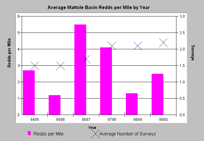
| Caption: The chart above shows the salmonid redds per mile for all spawning surveys in the Mattole basin over six years. The surveys use index reaches that may be subject to more than one survey in the season. Survey effort has increased over the six years, but the numbers of salmonid redds seen have not increased. Data provided by the Mattole Salmon Group. Click Info Links for more information. | |
 |
To learn more about this topic click Info Links .
To view a table of information about this data click Metadata .
To view the table with the chart's data, click Chart Table web page.
To download the table with the chart's data, click spawn9400_total.dbf (size 3,004 bytes) .
To view the table with the chart's source data, click Source Table web page.
To download the table with the chart's source data, click spawn9400.dbf (size 8,044 bytes)
| www.krisweb.com |