
| Area | Basin-wide/Regional |
| Topic | Flow: Mattole at Honeydew 1973-1977, Select Year |
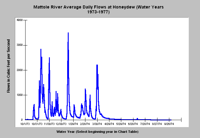
| Caption: This chart displays average daily flows in cubic feet per second by year for the Mattole River at Honeydew according to USGS stream gauge flow measurements. October 1 is the start of the water year. You may call up any water year by selecting the first record of that year (e.g. 10/1/1964) on the Chart Table then returning to the Chart and hitting the green recycle button on the right hand menu bar. The X axis of the graph may vary depending on the magnitude of the flows in any given year. Start the record on October 1, 1976 to see one of the driest years on record (1977 water year). | |
 |
To learn more about this topic click Info Links .
To view a table of information about this data click Metadata .
To view the table with the chart's data, click Chart Table web page.
To download the table with the chart's data, click flow_mat_honeydew.dbf (size 29,644 bytes) .
To view the table with the chart's source data, click Source Table web page.
To download the table with the chart's source data, click mathndfl.dbf (size 31,310 bytes)
| www.krisweb.com |