
| Area | Basin-wide/Regional |
| Topic | Flow: North Mattole 1952-1957, Select Year |
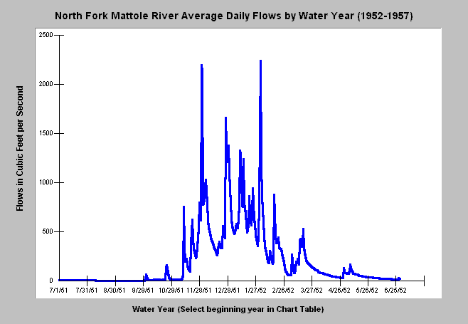
| Caption: This chart displays average daily flows in cubic feet per second by water year for the North Fork Mattole River at Petrolia beginning in July 1951. The data is from a USGS stream gauge. The water year typically runs from October 1 of the calendar year prior. You may call up any water year in the record by selecting one in the Chart Table (see instructions there). The X axis of the graph may vary depending on the magnitude of the flows in any given year. | |
 |
To learn more about this topic click Info Links .
To view a table of information about this data click Metadata .
To view the table with the chart's data, click Chart Table web page.
To download the table with the chart's data, click nfmattfl.dbf (size 41,210 bytes) .
| www.krisweb.com |