
| Area | Basin-wide/Regional |
| Topic | Sediment: D50 Values, Mattole Basin, 1992 & 2001 |
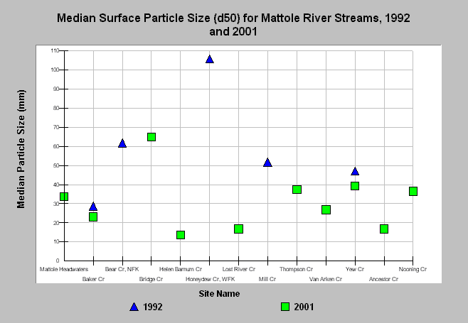
| Caption: The Chart above shows the D50, or median particle size distribution, derived from surface pebble counts of the streambed at several locations in the Mattole River basin for 1992 and 2001. A small median particle size can contribute to bedload mobility, which decreases salmonid spawning success. Data for 1992 is from Testing Indices of Cold Water Fish Habitat, Regional Water Board, 1993; 2001 is unpublished data collected by the Regional Water Board to assist in developing a Total Maximum Daily Load for sediment for the Mattole Basin. See Info Links for more information and links to bibliographic resources. | |
 |
To learn more about this topic click Info Links .
To view a table of information about this data click Metadata .
To view the table with the chart's data, click Chart Table web page.
To download the table with the chart's data, click d50smattole_92_2001.db (size 4,096 bytes) .
| www.krisweb.com |