
| Area | Basin-wide/Regional |
| Topic | Sediment: V* Averages by Mattole Salmon Group for All Reaches, 2000 |
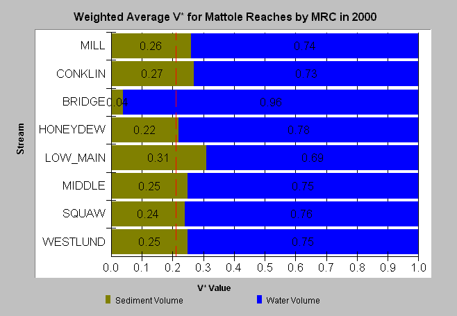
| Caption: This chart displays average V* values for all Mattole sites sampled in 2000. V* is in decimal percent. A V* of 0.50 indicates that half of the pool is filled with fine sediment. The 0.21 target threshold is from the TMDL for the Big River and other North Coast Rivers. Data are provided by the Mattole Salmon Group. See Info Links for more information. | |
 |
To learn more about this topic click Info Links .
To view a table of information about this data click Metadata .
To view the table with the chart's data, click Chart Table web page.
To download the table with the chart's data, click msg_vstar_wavg.dbf (size 1,058 bytes) .
To view the table with the chart's source data, click Source Table web page.
To download the table with the chart's source data, click msg_vstar_src.dbf (size 5,462 bytes)
| www.krisweb.com |