
| Area | Basin-wide/Regional |
| Topic | Temperature: TIR Longitudinal Profile, Mattole River, 2001 |
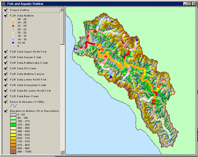
This screen capture from the KRIS Mattole Map Project shows surface water temperature (°C) in the Mattole River and its tributaries. Data was derived from a helicopter-mounted thermal infrared (TIR) sensor by Watershed Sciences for the North Coast Regional Water Quality Control Board (2002). See Info Links for more information.
 Click on image to enlarge (150K).
To learn more about this topic click Info Links
| www.krisweb.com |