| Area |
Basin-wide/Regional |
| Topic |
Tour: Aerial Photos 1992 |
 Click on image to enlarge (86K). Click here to display a larger version (841K).
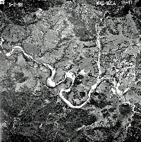
This 1992 aerial photograph of the lower Mattole River, including its convergence with the North Fork, shows that the river is still highly aggraded.
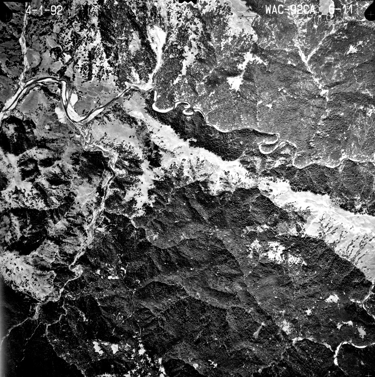
 Click on image to enlarge (127K). Click here to display a larger version (1,104K).
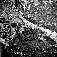
This April 1992 aerial photograph shows the Mattole River at Honeydew. The riparian at the mouth of Honeydew Creek has improved since 1984. Riparian re-growth in much of the Mattole was aided by drought conditions which prevailed from 1987-1992 and did not scour gravel bars frequently.
 Click on image to enlarge (102K). Click here to display a larger version (893K).
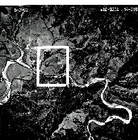
This aerial photograph taken on May 2, 1992 shows the mouth of the North Fork Mattole River as it joins the mainstem. The flood plane at the mouth is similar in width to the 1984 aerial photo, indicating that the North Fork is not experiencing channel recovery in this reach.
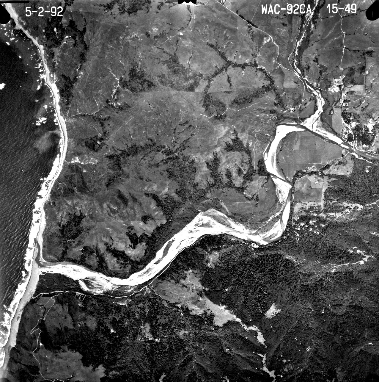
 Click on image to enlarge (91K). Click here to display a larger version (887K).
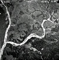
This May 1992 aerial photograph shows the lower Mattole River and estuary. The broad flood plane indicates a chronic over-supply of sediment. Filling of the estuary is thought to be a major constraint on habitat critical for Chinook salmon survival.
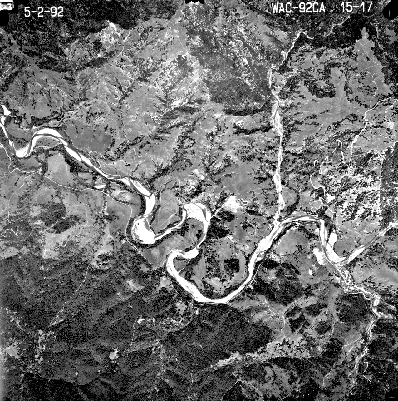
 Click on image to enlarge (120K). Click here to display a larger version (1,059K).
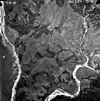
The aerial photograph above shows the Mattole River between Petrolia and Honeydew in May 1992. The flood plane remains very broad, indicating high sediment supply. The track of a debris torrent is apparent in the tributary channel at the upper right in the photo.
To learn more about this topic click Info Links

 Click on image to enlarge (86K). Click here to display a larger version (841K).
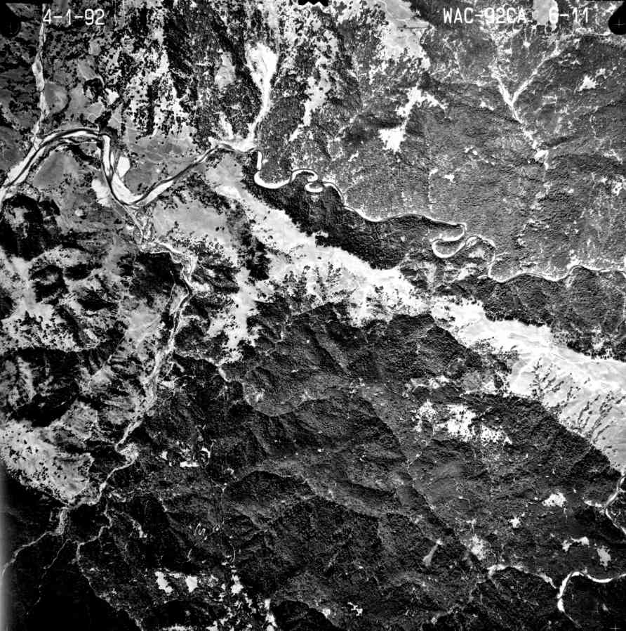 Click on image to enlarge (127K). Click here to display a larger version (1,104K).
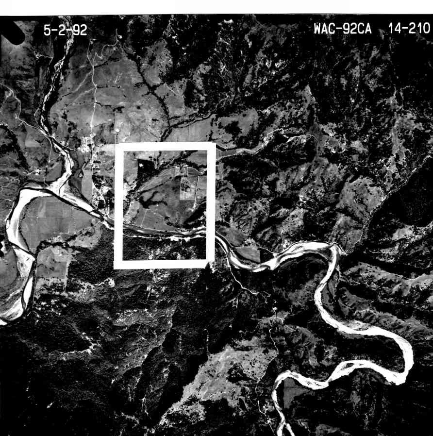 Click on image to enlarge (102K). Click here to display a larger version (893K).
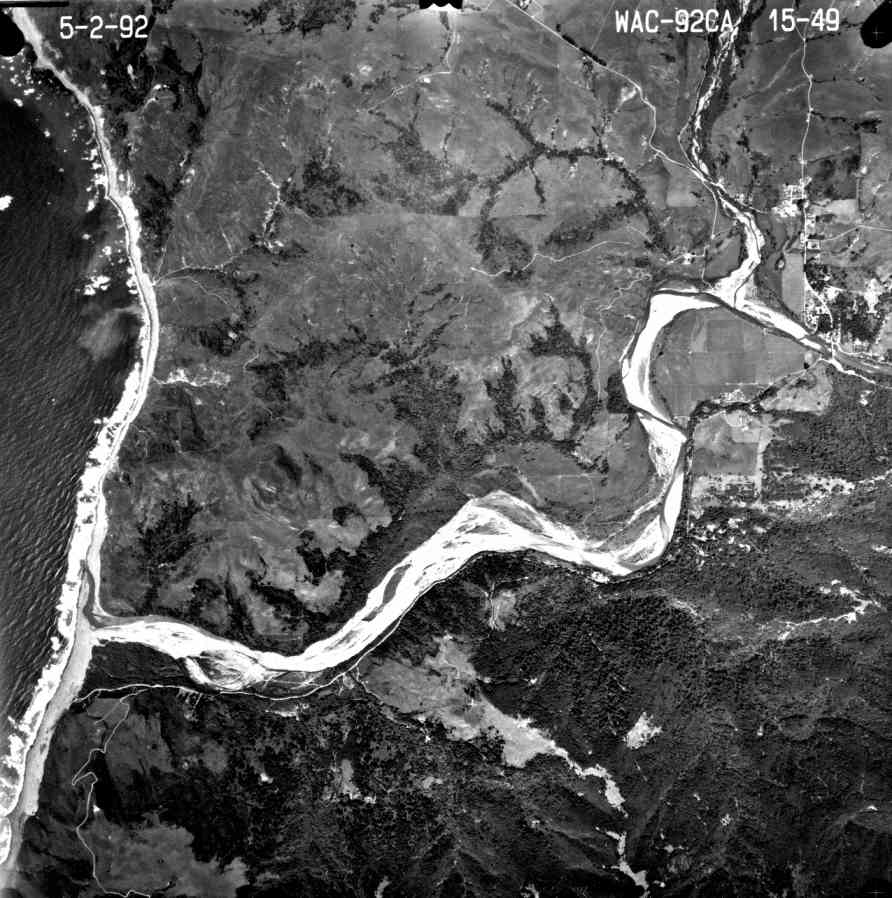 Click on image to enlarge (91K). Click here to display a larger version (887K).
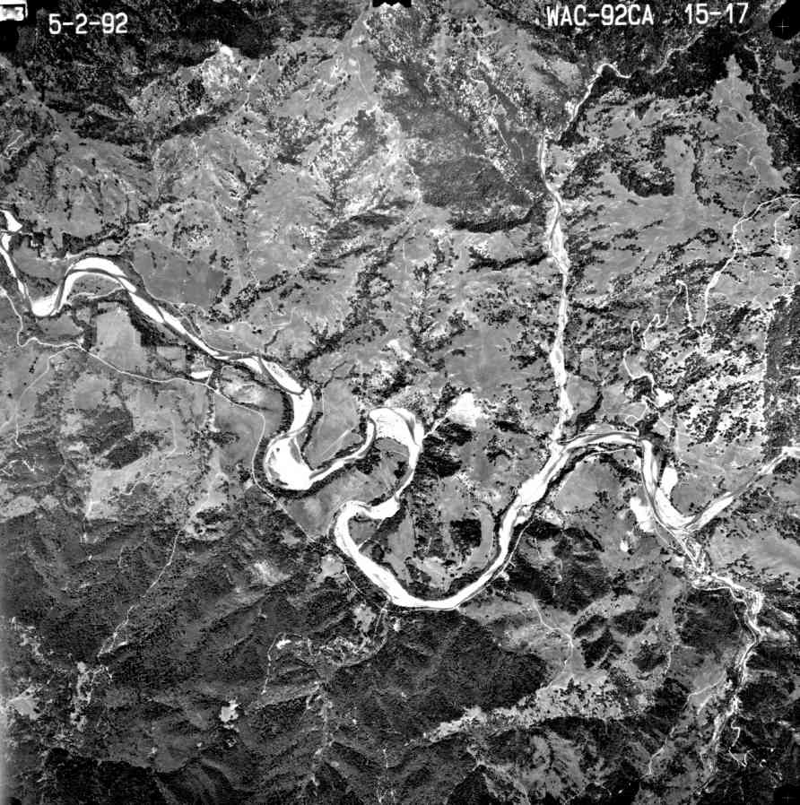 Click on image to enlarge (120K). Click here to display a larger version (1,059K).
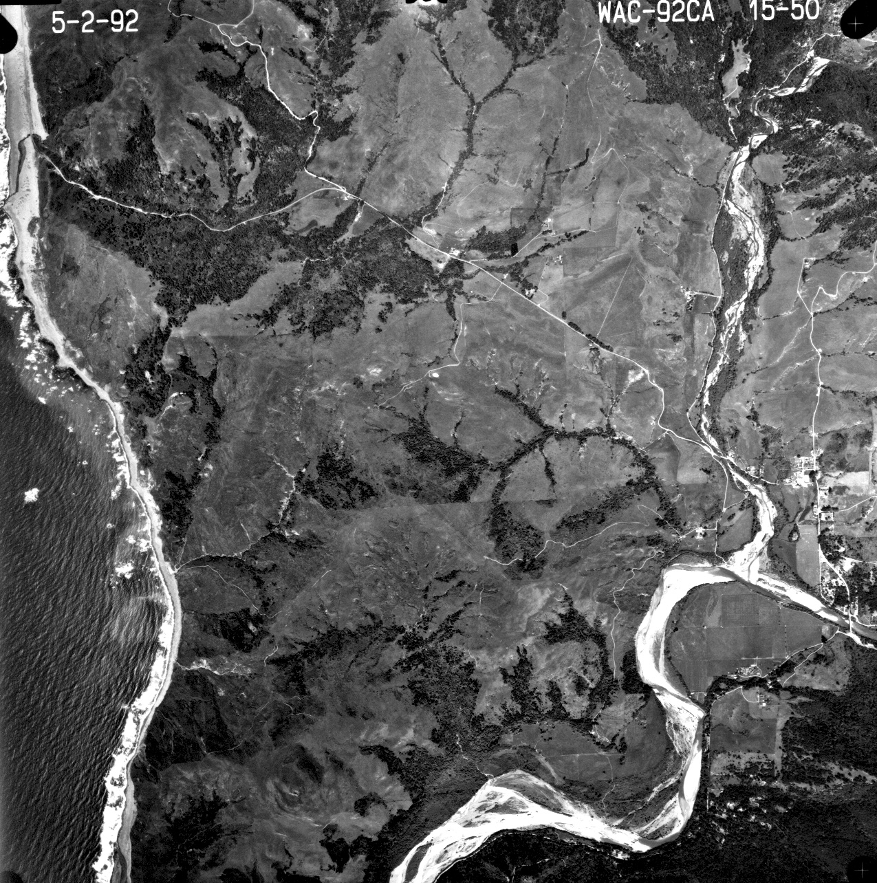