| Area |
Basin-wide/Regional |
| Topic |
Tour: Aerial Photos North Fork Mattole |
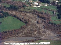 Click on image to enlarge (75K). Click here to display a larger version (178K).
This photo shows the mouth of the North Fork Mattole River with a wide and braided channel. Photo provided by the Mattole Restoration Council. Taken in Spring 1997.
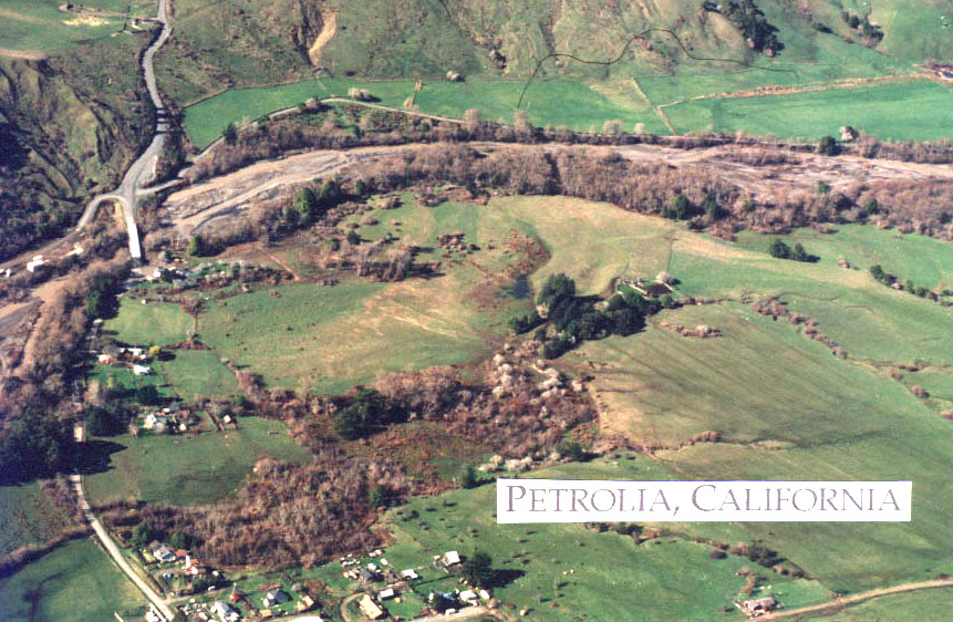
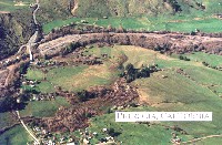 Click on image to enlarge (74K). Click here to display a larger version (178K).
This photo shows the lower North Fork Mattole River and the town of Petrolia. Photo provided by the Mattole Restoration Council. Taken in Spring 1997.
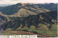 Click on image to enlarge (100K).
This aerial photograph shows the lower North Fork Mattole River watershed. The watershed has a mixture of grasslands and forested areas.
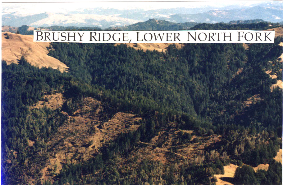
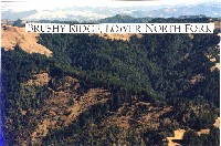 Click on image to enlarge (86K). Click here to display a larger version (176K).
This aerial photograph was taken in Spring 1997 and shows patch clear cuts along Brushy Ridge in the North Fork Mattole watershed. Photo provided by the Mattole Restoration Council.
 Click on image to enlarge (81K). Click here to display a larger version (168K).
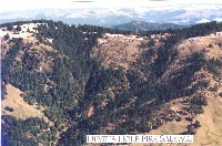
This aerial photograph shows the North Fork Mattole watershed where salvage logging took place after a fire. Photo provided by the Mattole Restoration Council. Photo taken in 1997.
 Click on image to enlarge (80K). Click here to display a larger version (164K).
This aerial photograph shows gully erosion related to a road in the North Fork Mattole River drainage. Grasslands in the headwater areas of the North Fork are very subject to gully erosion when disturbed. Roads change drainage patterns and exacerbate this problem. Photo provided by the Mattole Restoration Council.
 Click on image to enlarge (145K).
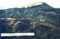
This aerial photograph shows clear cuts in the Long Ridge area of the North Fork Mattole watershed. The timber harvests took place in 1992 but the photo was taken in 1997.
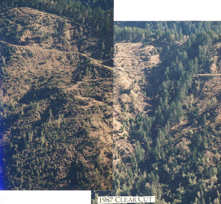
 Click on image to enlarge (86K). Click here to display a larger version (206K).
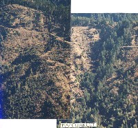
These two aerial photographs show clear cuts in steep upland terrain of the North Fork Mattole watershed. Note the poor regeneration that has occurred on these sites that were logged in 1987 and the large areas of surface erosion. Photo courtesy of the Mattole Restoration Council. Taken in 1997.
To learn more about this topic click Info Links

 Click on image to enlarge (75K). Click here to display a larger version (178K).
 Click on image to enlarge (74K). Click here to display a larger version (178K).
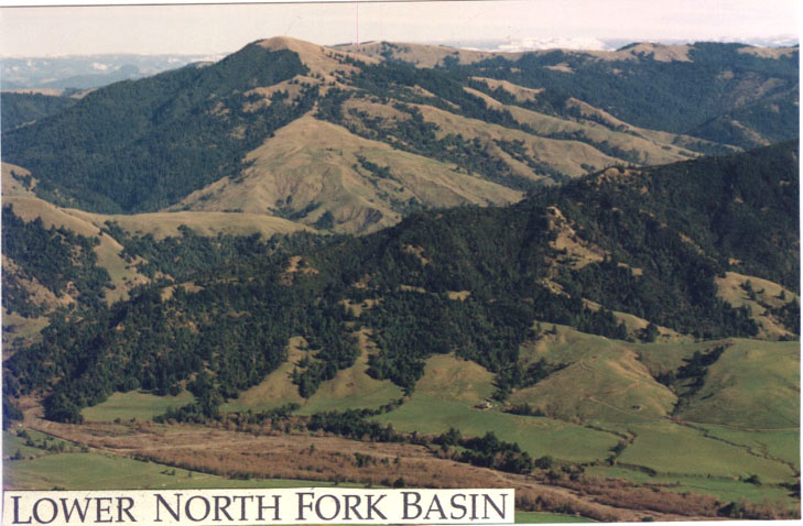 Click on image to enlarge (100K).
 Click on image to enlarge (86K). Click here to display a larger version (176K).
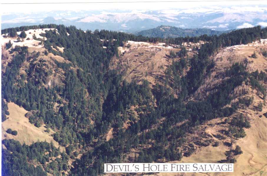 Click on image to enlarge (81K). Click here to display a larger version (168K).
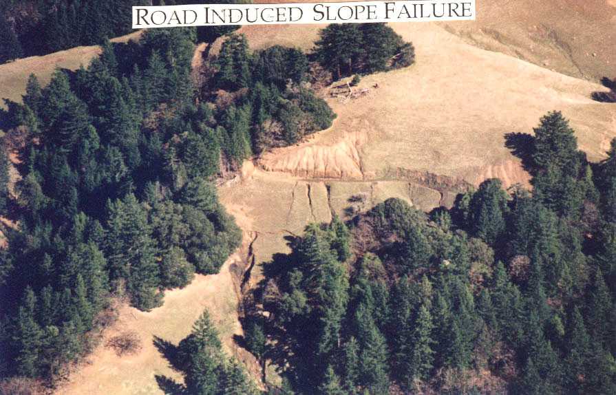 Click on image to enlarge (80K). Click here to display a larger version (164K).
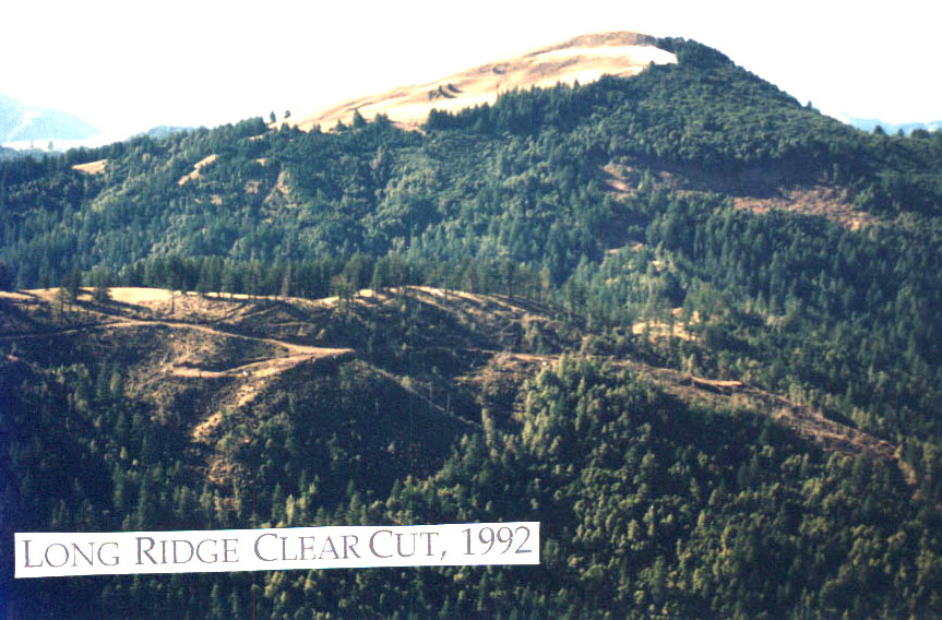 Click on image to enlarge (145K).
 Click on image to enlarge (86K). Click here to display a larger version (206K).
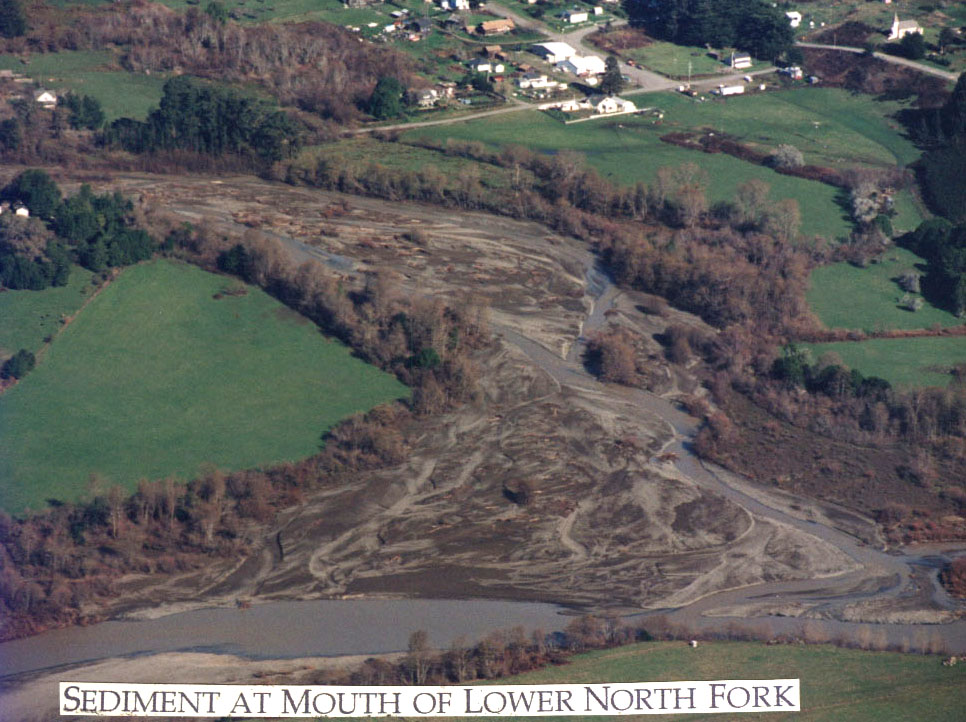