| Area |
Basin-wide/Regional |
| Topic |
Tour: Landslides and Erosion |
 Click on image to enlarge (94K). Click here to display a larger version (190K).
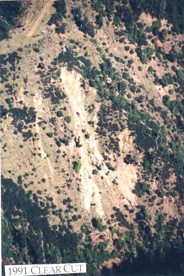
This photograph shows slope failure after logging in the North Fork Mattole River basin. Landslides often occur in steep areas that have been logged after tree roots rot out. This slope was logged in 1991 and the landslide occurred in 1997. Photograph provided by the Mattole Restoration Council.
 Click on image to enlarge (98K). Click here to display a larger version (207K).
This aerial photograph shows a debris torrent that started in a recently logged area in the North Fork Mattole basin. Logging in steep headwall areas often triggers landslides and the risk of slope failure may extend for as long as 30 years. Trees roots can keep steep soil masses in place. After logging root eventually rot, then contributing to the risk of landslides. Photo provided by the Mattole Restoration Council.
 Click on image to enlarge (99K). Click here to display a larger version (204K).
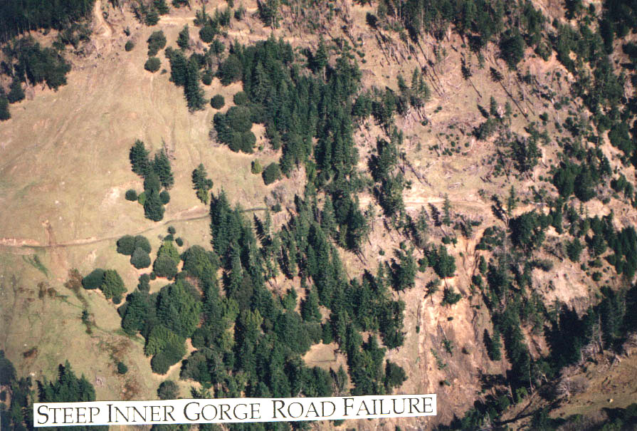
This aerial photograph shows a landslide at an inner gorge location above a tributary to the North Fork Mattole River. The slide appears to have been triggered by a logging road failure at a mid-slope location. Photo provided by the Mattole Restoration Council.
To learn more about this topic click Info Links

 Click on image to enlarge (94K). Click here to display a larger version (190K).
 Click on image to enlarge (98K). Click here to display a larger version (207K).
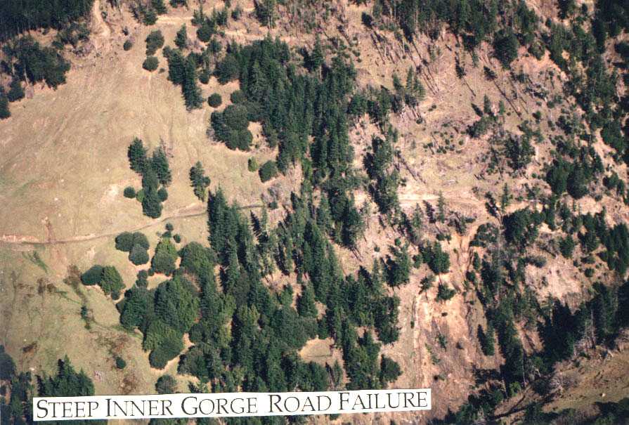 Click on image to enlarge (99K). Click here to display a larger version (204K).