
| Area | Eastern Mattole |
| Topic | Temperature: Floating Weekly Avg, Westlund Cr - Lower, 2001 |
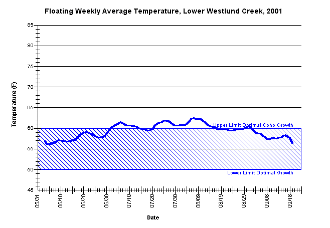
| Caption: The maximum floating weekly average water temperatures for lower Westlund Creek approximately 0.1 miles upstream from its confluence with the Mattole River, from May 31 through October 21, 2001. MSG records state that the thermograph went dry after October 21, 2001 so all subsequent data after that date was discarded. Data may still be useable as all maximum temperatures and MWATs for MSGs year 2001 sampling efforts, except for Clear Creek, were recorded prior to October 10, 2001. The thermograph was placed by the Mattole Salmon Group using Forest Science Project protocols. | |
 |
To learn more about this topic click Info Links .
To view a table of information about this data click Metadata .
To view the table with the chart's data, click Chart Table web page.
To download the table with the chart's data, click 86472_low_westlund.db (size 6,144 bytes) .
To view the table with the chart's source data, click Source Table web page.
To download the table with the chart's source data, click matt_temp_eastmsg_source.dbf (size 978,895 bytes)
| www.krisweb.com |