
| Area | Eastern Mattole |
| Topic | Habitat: Pool Depth by Percent Survey Length for Eastern Reaches |
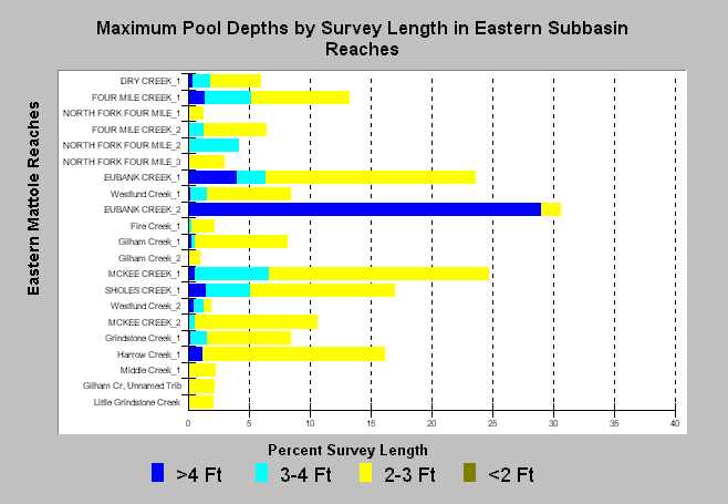
| Caption: The California Department of Fish and Game measures maximum depth for every pool surveyed. Pools with depths in excess of 3 feet provide higher quality salmonid rearing and holding habitat. Larger streams naturally provide deeper pools. Stream order, albeit imprecise and providing few categories for size ranking were used to arrange reaches from top (higher order; large) to bottom (lower order; small). See Info Links for more information. | |
 |
To learn more about this topic click Info Links .
To view a table of information about this data click Metadata .
To view the table with the chart's data, click Chart Table web page.
To download the table with the chart's data, click hab_matea_reach.db (size 16,384 bytes) .
To view the table with the chart's source data, click Source Table web page.
To download the table with the chart's source data, click reachsum_habraw_mattole.db (size 45,056 bytes)
| www.krisweb.com |