
| Area | Eastern Mattole |
| Topic | Temperature: MWATs in Eastern Tributaries (Fahrenheit) |
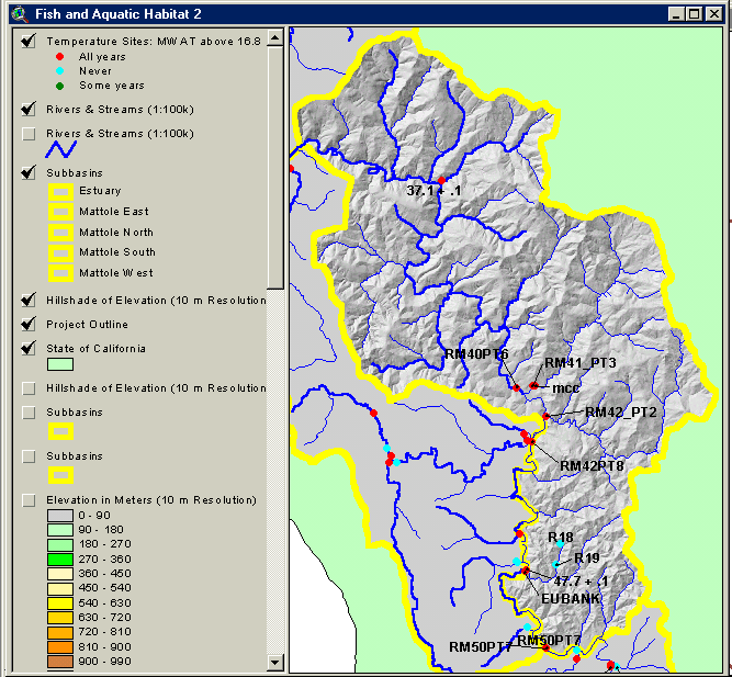
This image from the KRIS Mattole Map Project in Arcview shows the location of temperature monitoring sites in the Eastern Mattole Sub-basin which is highlighted with a topographic backdrop. Sites where maximum floating weekly temperature exceeded 16.8 degrees C in all recorded years appear as red dots. Site labels come from the ORIG_ID column of the chart table and correspond to stream names and data originator as follows (press F7 for best view):
ORIG_ID STRMNAME CONTRIB
RM42_PT2 Blue Slide Creek FSP
RM41_PT3 Mattole Canyon Creek FSP
RM40PT6 Mattole River FSP
RM42PT8 Mattole River FSP
R19 Sweet Home Creek : Lower FSP
R18 Sweet Home Creek : Upper FSP
47.7 + .1 Eubank Creek Mattole Salmon Group
37.1 + .1 Westlund Creek Mattole Salmon Group
EUBANK Eubank Creek NCRWQCB
mcc Mattole Canyon Creek NCRWQCB
1.3 + .1 Stansberry Creek Mattole Salmon Group
 Click on image to enlarge (105K).
To learn more about this topic click Info Links
| www.krisweb.com |