
| Area | Northern Mattole |
| Topic | Habitat: Pool Depths by Occurrence for Northern Tribs |
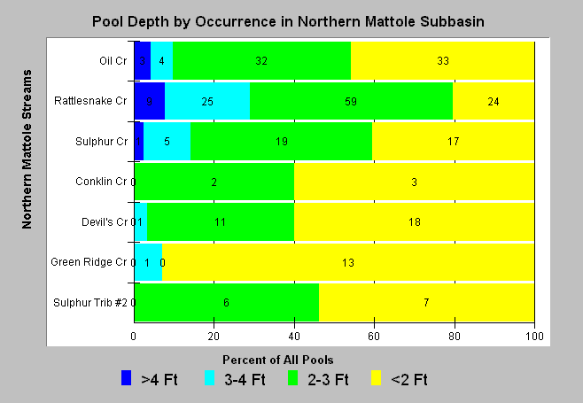
| Caption: The California Department of Fish and Game measures maximum depth for every pool surveyed. The numbers of pools found with each category of maximum depths are shown on the chart. Pools with depths in excess of 3 feet provide higher quality salmonid rearing and holding habitat. Stream order was used to arrange reaches from top (higher order; large) to bottom (lower order; small) but is an imprecise index of stream size. See Info Links for more information. | |
 |
To learn more about this topic click Info Links .
To view a table of information about this data click Metadata .
To view the table with the chart's data, click Chart Table web page.
To download the table with the chart's data, click hab_mat_no_strm_m.dbf (size 6,451 bytes) .
To view the table with the chart's source data, click Source Table web page.
To download the table with the chart's source data, click hab_mattole_streamsum_m.dbf (size 29,582 bytes)
| www.krisweb.com |