
| Area | Northern Mattole |
| Topic | Sediment: Fines <0.85 mm at Oil and Rattlesnake Creek 1991-1995 |
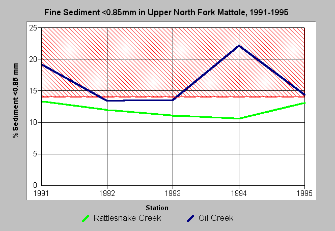
| Caption: Upper North Fork monitoring sites were sampled in 1991-1995 as part of what was meant to be a long-term study of different conditions among watersheds with different levels of disturbance. Rattlesnake Creek was considered the relative "control" because of lower road density and timber harvest. The Rattlesnake Creek site meets TMDL targets thresholds for fine sediment (<0.85 mm) set for other north coast rivers (red line). See Info Links for more information. | |
 |
To learn more about this topic click Info Links .
To view a table of information about this data click Metadata .
To view the table with the chart's data, click Chart Table web page.
To download the table with the chart's data, click dfgunf_sed85.db (size 4,096 bytes) .
To view the table with the chart's source data, click Source Table web page.
To download the table with the chart's source data, click dfgunf_src.dbf (size 1,338 bytes)
| www.krisweb.com |