
| Area | Northern Mattole |
| Topic | Sediment: Fines <0.85mm at PALCO Stations |
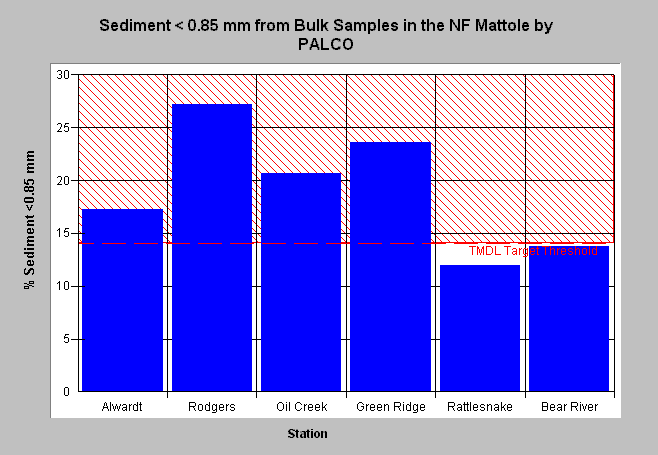
| Caption: Alwardt, Rodgers, Oil, and Green Ridge Creeks show percentages of fine sediment (<0.85 mm). Bear River is north of the Mattole basin. See Info Links for more information. Data obtained from Pacific Lumber HCP. | |
 |
To learn more about this topic click Info Links .
To view a table of information about this data click Metadata .
To view the table with the chart's data, click Chart Table web page.
To download the table with the chart's data, click sedsum_pl.dbf (size 640 bytes) .
To view the table with the chart's source data, click Source Table web page.
To download the table with the chart's source data, click sedtemp_pl.dbf (size 53,288 bytes)
| www.krisweb.com |