
| Area | Northern Mattole |
| Topic | Sediment: Road Densities in PALCO Watersheds |
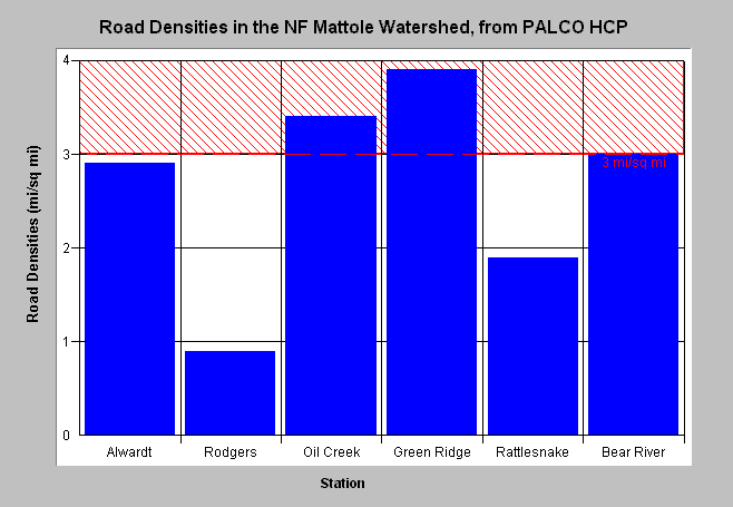
| Caption: The road density road density data reported in the PALCO HCP is shown above. This data does not reflect skid trails and some spur roads. Studies in Washington State (Cederholm, 1981) and reviews by the National Marine Fisheries Service have found that fine sediment in salmon redds increased as road densities exceeded 3 miles of road per square mile of landscape. This reference value is thus shown in red. Bear River is north of the Mattole basin. Click on Info Links for more information. | |
 |
To learn more about this topic click Info Links .
To view a table of information about this data click Metadata .
To view the table with the chart's data, click Chart Table web page.
To download the table with the chart's data, click sedsum_pl.dbf (size 640 bytes) .
To view the table with the chart's source data, click Source Table web page.
To download the table with the chart's source data, click sedtemp_pl.dbf (size 53,288 bytes)
| www.krisweb.com |