
| Area | Northern Mattole |
| Topic | Temperature: MWATs in Northern Tributaries (Fahrenheit) |
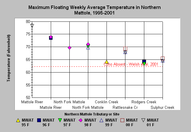
| Caption: This chart plots the maximum floating weekly average temperature (MWAT) for each measured site in the Northern Mattole by year. Where duplicate streams names appear the sites are arranged in downstream (left) to upstream (right) order. All sites show temperatures exceeding stress thresholds for salmonids according to Welsh et al (2001). Data was provided by the NCRWQCB and originated from several sources (see Chart Table). Also see Info Links for more information. | |
 |
To learn more about this topic click Info Links .
To view a table of information about this data click Metadata .
To view the table with the chart's data, click Chart Table web page.
To download the table with the chart's data, click temp_mwat_north.db (size 8,192 bytes) .
To view the table with the chart's source data, click Source Table web page.
To download the table with the chart's source data, click temp_mwats.xls.db (size 38,912 bytes)
| www.krisweb.com |