
| Area | Northern Mattole |
| Topic | Temperature: Min, Max, Avg, Mattole River at Petrolia, 2001 |
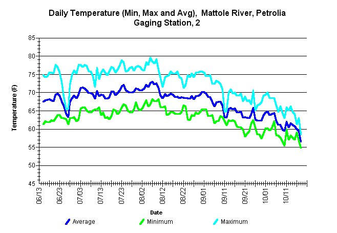
| Caption: Average, minimum and maximum water temperatures during year 2001for the mainstem Mattole River. The thermograph was placed near the Petrolia gauging station approximately 75 yds downstream from the Petrolia Bridge. Data was collected and analyzed by the NCRWQCB. | |
 |
To learn more about this topic click Info Links .
To view a table of information about this data click Metadata .
To view the table with the chart's data, click Chart Table web page.
To download the table with the chart's data, click mattemp01_mma.db (size 110,592 bytes) .
To view the table with the chart's source data, click Source Table web page.
To download the table with the chart's source data, click mattemp01_mma.db (size 110,592 bytes)
| www.krisweb.com |