| Area |
Northern Mattole |
| Topic |
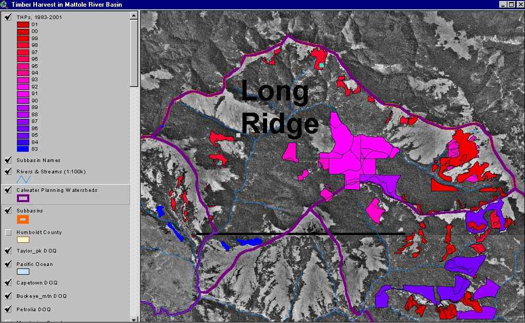
Timber Harvest: Annual Percent Area Harvested, Long Ridge CW 1983-2001 |
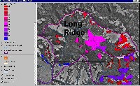 Click on image to enlarge (97K). Click here to display a larger version (176K).
The image above shows the Timber Harvest Plans approved (but not necessarily implemented) between 1983 and 2001 in the Long Ridge Calwater Planning Watershed, overlayed on top of USGS Digital Orthophoto Quadrangles (DOQs) . This image was captured from the KRIS Mattole Map project.
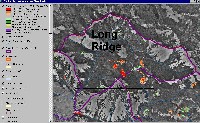
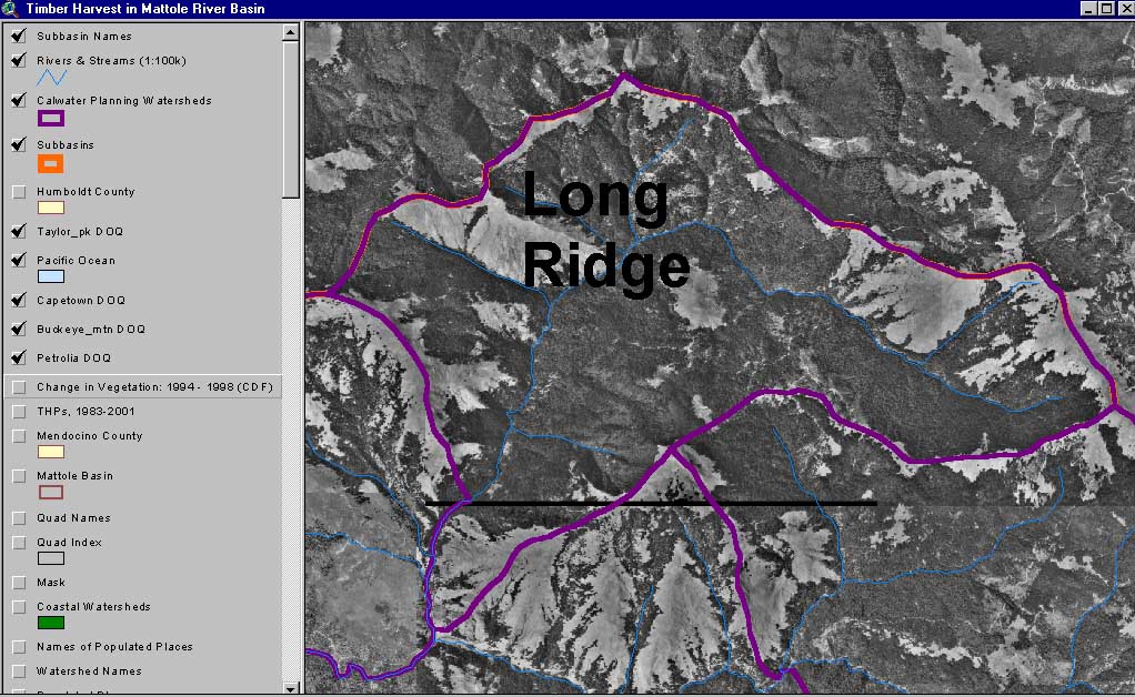
 Click on image to enlarge (94K). Click here to display a larger version (163K).
The image above shows the USGS Digital Orthophoto Quadrangles (DOQs) in the Long Ridge Calwater Planning Watershed. This image was captured from the KRIS Mattole Map project.
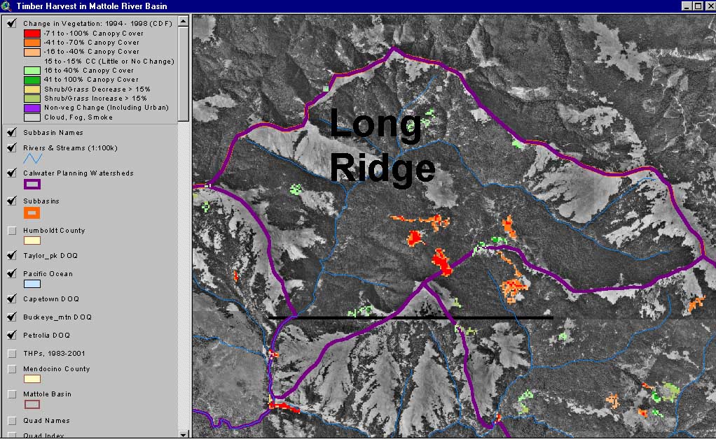
 Click on image to enlarge (100K). Click here to display a larger version (175K).
The image above shows the change in vegetation (calculated by the California Department of Forestry using satellite images) between 1994 and 1998 in the Long Ridge Calwater Planning Watershed , overlayed on top of USGS Digital Orthophoto Quadrangles (DOQs). Green represents re-vegetation and red represents loss of canopy cover. This image was captured from the KRIS Mattole Map project.
To learn more about this topic click Info Links

 Click on image to enlarge (97K). Click here to display a larger version (176K).
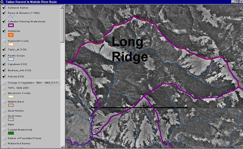 Click on image to enlarge (94K). Click here to display a larger version (163K).
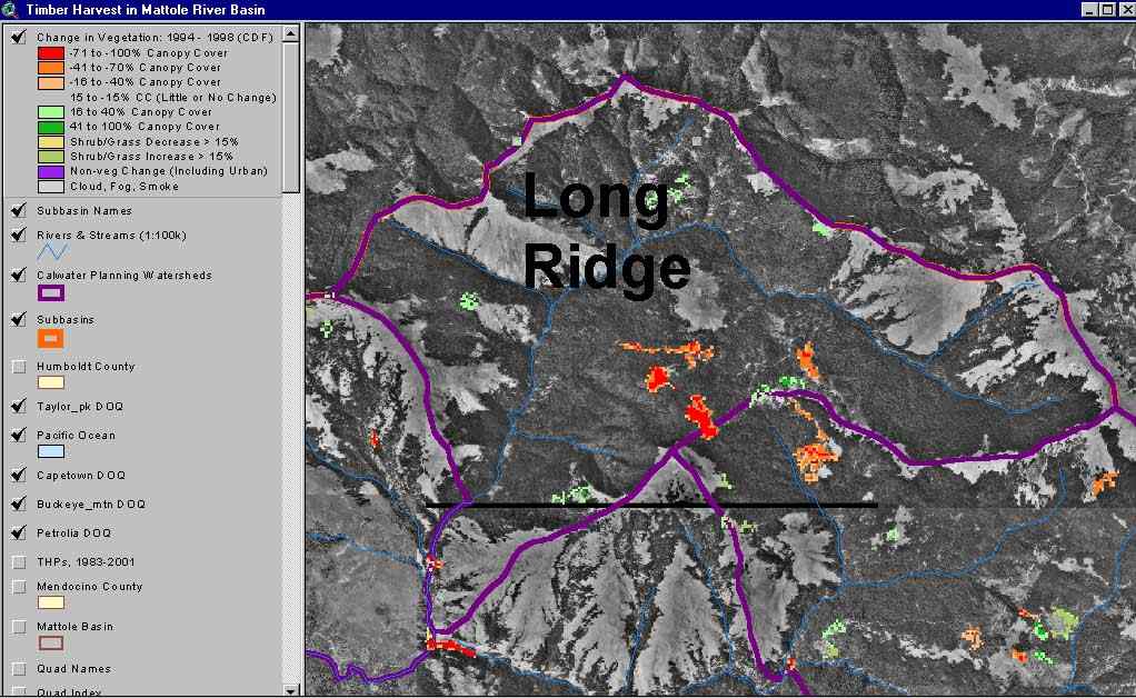 Click on image to enlarge (100K). Click here to display a larger version (175K).
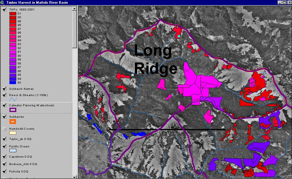