
| Area | Southern Mattole |
| Topic | Sediment: V* From Yew Creek, 1992 |
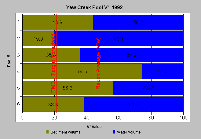
| Caption: The weighted reach average V* in Yew Creek was 45% when measured in 1992. The weighted reach average factors pool size in order to more accurately represent the cumulative residual area of reach pools. The 21% target is from the TMDL for the Big River and other North Coast Rivers. A V* of 50% indicates that half of the pool is filled with fine sediment. Data provided by the North Coast Regional Water Quality Control Board. See Info Links for more information. | |
 |
To learn more about this topic click Info Links .
To view a table of information about this data click Metadata .
To view the table with the chart's data, click Chart Table web page.
To download the table with the chart's data, click v_star_yew_92.dbf (size 912 bytes) .
To view the table with the chart's source data, click Source Table web page.
To download the table with the chart's source data, click knopp.dbf (size 12,582 bytes)
| www.krisweb.com |