
| Area | Southern Mattole |
| Topic | Temperature: Floating Weekly Average, Southern Tributaries 1996 |
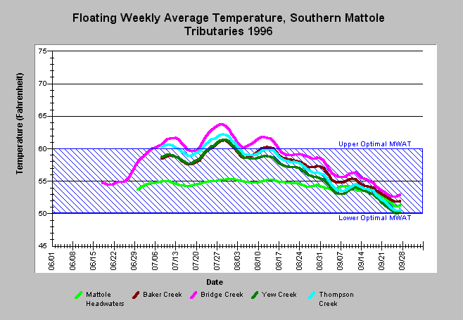
| Caption: The graph above shows floating weekly average water temperature for two Thompson Creek sites in 1996. The maximum floating weekly average temperature (MWAT) was 61 at the upper site and 62 at the lower site, with only one degree of difference throughout the season. Click on Picture for a view of locations. Data provided by the Forest Science Project. Click on Info Links for more information. | |
 |
To learn more about this topic click Info Links .
To view a table of information about this data click Metadata .
To view the table with the chart's data, click Chart Table web page.
To download the table with the chart's data, click tempraw_fsp_so_daily.db (size 505,856 bytes) .
To view the table with the chart's source data, click Source Table web page.
To download the table with the chart's source data, click tempraw_fsp_so.db (size 2,594,816 bytes)
| www.krisweb.com |